Freystadt night lights from space
Night Light of Freystadt (Bavaria) from space (Germany) Src. Average luminocity for 10x10km area is 0.7087% and for 50x50km: 5.1012%.
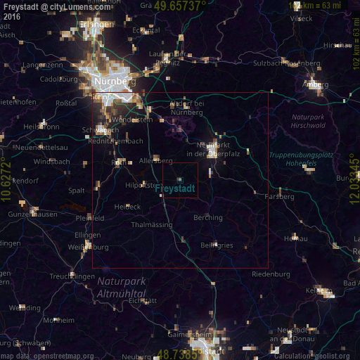
Analysis of Freystadt night lights 2016
Square area 10x10 km:
 0%
0%90-99
0%80-89
0%70-79
0%60-69
0%50-59
0.56%40-49
0%30-39
0%20-29
1.12%10-19
0%0-9
98.32%Square area 50x50 km:
0.82%90-99
0.87%80-89
0.35%70-79
0.48%60-69
0.66%50-59
0.71%40-49
0.76%30-39
1%20-29
1.46%10-19
2.9%0-9
89.99%Clear (daylight) street map image can be seen on geolist.org.
Map coordinates:
49° 39' 26.5" North, 10° 37' 37.9" East
49° 12' 0.3" North, 11° 19' 49.2" East
48° 44' 18.6" North, 12° 2' 0.4" East
Some cities around Freystadt sort by population:
• Neumarkt in der Oberpfalz
13.1 km =8.1 mi,  47°
47°
• Hilpoltstein
10.2 km =6.3 mi,  263°
263°
• Berching
13.1 km =8.1 mi,  142°
142°
• Allersberg
8.9 km =5.5 mi,  309°
309°
• Postbauer-Heng
11.9 km =7.4 mi,  9°
9°
• Pyrbaum
11.2 km =7 mi,  343°
343°
• Thalmässing
14.7 km =9.1 mi,  212°
212°
• Heideck
16.5 km =10.3 mi,  243°
243°
2924854 (p: 8,555)
Sources (retrieved 2019-11-25):
» Earth at Night: Flat Maps 2012, 2016