Thalmässing night lights from space
Night Light of Thalmässing (Bavaria) from space (Germany) Src. Average luminocity for 10x10km area is 0.0252% and for 50x50km: 2.1359%.
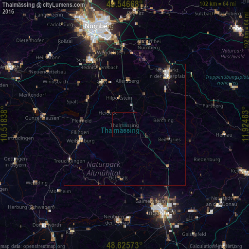
Analysis of Thalmässing night lights 2016
Square area 10x10 km:
 0%
0%90-99
0%80-89
0%70-79
0%60-69
0%50-59
0%40-49
0%30-39
0%20-29
0%10-19
0%0-9
100%Square area 50x50 km:
0.16%90-99
0.34%80-89
0.21%70-79
0.2%60-69
0.33%50-59
0.17%40-49
0.48%30-39
0.38%20-29
0.36%10-19
1.14%0-9
96.21%Clear (daylight) street map image can be seen on geolist.org.
Map coordinates:
49° 32' 48" North, 10° 31' 6.2" East
49° 5' 18" North, 11° 13' 17.4" East
48° 37' 32.6" North, 11° 55' 28.7" East
Some cities around Thalmässing sort by population:
• Hilpoltstein
11.6 km =7.2 mi,  348°
348°
• Berching
16.1 km =10 mi,  82°
82°
• Freystadt
14.7 km =9.1 mi,  32°
32°
• Allersberg
18.2 km =11.3 mi,  3°
3°
• Pleinfeld
17.5 km =10.9 mi,  275°
275°
• Greding
10.9 km =6.8 mi,  114°
114°
• Georgensgmünd
18.7 km =11.6 mi,  307°
307°
• Heideck
8.5 km =5.3 mi, 306°
2823044 (p: 5,442)
Sources (retrieved 2019-11-25):
» Earth at Night: Flat Maps 2012, 2016