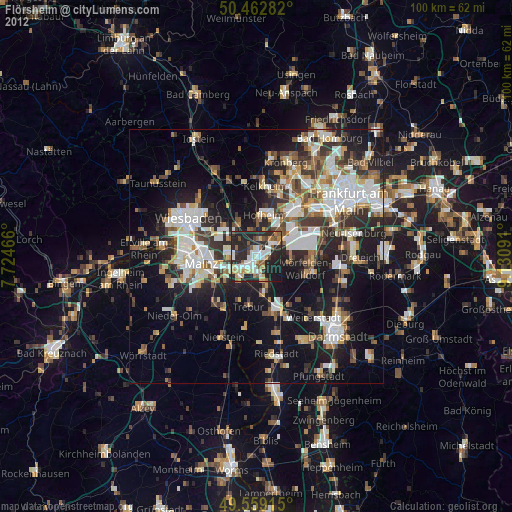
Flörsheim night lights from space
Night Light of Flörsheim (Hesse) from space (Germany) Src. Average luminocity for 10x10km area is 50.119% and for 50x50km: 30.766%.
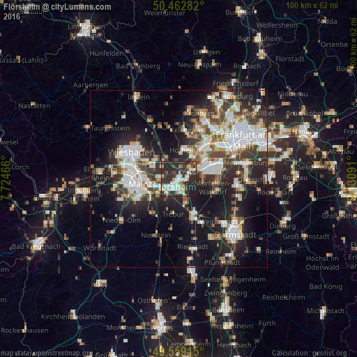
Analysis of Flörsheim night lights 2016
Square area 10x10 km:
 10.36%
90-99
12.46%80-89
4.48%70-79
4.76%60-69
3.22%50-59
3.5%40-49
4.62%30-39
9.66%20-29
38.94%10-19
7.98%0-9
0%Square area 50x50 km:
7.18%90-99
6.59%80-89
2.56%70-79
2.69%60-69
3.12%50-59
2.73%40-49
4.17%30-39
5.41%20-29
10.17%10-19
16.32%0-9
39.07%Clear (daylight) street map image can be seen on geolist.org.
Map coordinates:
50° 27' 46.2" North, 7° 43' 28.8" East
50° 0' 47.2" North, 8° 25' 40" East
49° 33' 32.9" North, 9° 7' 51.3" East
Some cities around Flörsheim sort by population:
• Rüsselsheim
2.6 km =1.6 mi,  188°
188°
• Hofheim am Taunus
8.7 km =5.4 mi,  10°
10°
• Hattersheim
8 km =5 mi,  25°
25°
• Hochheim am Main
5.4 km =3.4 mi,  271°
271°
• Ginsheim-Gustavsburg
7.5 km =4.7 mi,  231°
231°
• Raunheim
1.8 km =1.1 mi,  89°
89°
• Bischofsheim
4.8 km =3 mi,  243°
243°
• Kriftel
8.4 km =5.2 mi,  20°
20°
2926120 (p: 20,023)
Sources (retrieved 2019-11-25):
» Earth at Night: Flat Maps 2012, 2016