Bordesholm night lights from space
Night Light of Bordesholm (Schleswig-Holstein) from space (Germany) Src. Average luminocity for 10x10km area is 2.2538% and for 50x50km: 6.1006%.
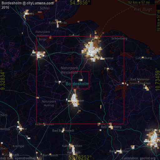
Analysis of Bordesholm night lights 2016
Square area 10x10 km:
 0.38%
0.38%90-99
0.13%80-89
0%70-79
0.51%60-69
0%50-59
0.51%40-49
0.51%30-39
0%20-29
0%10-19
0.25%0-9
97.73%Square area 50x50 km:
1.18%90-99
1.4%80-89
0.56%70-79
0.51%60-69
0.52%50-59
0.6%40-49
0.78%30-39
0.74%20-29
1.27%10-19
4.71%0-9
87.72%Clear (daylight) street map image can be seen on geolist.org.
Map coordinates:
54° 35' 8.2" North, 9° 19' 42" East
54° 10' 34" North, 10° 1' 53.3" East
53° 45' 45.1" North, 10° 44' 4.5" East
Some cities around Bordesholm sort by population:
• Kiel
17.5 km =10.9 mi,  22°
22°
• Neumünster
11.7 km =7.3 mi,  195°
195°
• Preetz
17.3 km =10.7 mi,  67°
67°
• Kronshagen
17.8 km =11.1 mi,  10°
10°
• Raisdorf
18.4 km =11.4 mi,  50°
50°
• Flintbek
8.5 km =5.3 mi, 15°
• Nortorf
11.6 km =7.2 mi,  265°
265°
• Klausdorf
18.9 km =11.7 mi,  38°
38°
2946321 (p: 7,709)
Sources (retrieved 2019-11-25):
» Earth at Night: Flat Maps 2012, 2016