Emden night lights from space
Night Light of Emden (Lower Saxony) from space (Germany) Src. Average luminocity for 10x10km area is 28.9405% and for 50x50km: 3.47%.
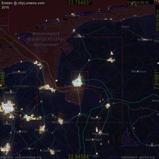
Analysis of Emden night lights 2016
Square area 10x10 km:
 8.73%
8.73%90-99
6.35%80-89
2.25%70-79
2.38%60-69
2.38%50-59
1.85%40-49
1.85%30-39
1.32%20-29
3.57%10-19
29.89%0-9
39.42%Square area 50x50 km:
0.62%90-99
0.55%80-89
0.35%70-79
0.4%60-69
0.25%50-59
0.46%40-49
0.41%30-39
0.18%20-29
0.32%10-19
2.43%0-9
94.01%Clear (daylight) street map image can be seen on geolist.org.
Map coordinates:
53° 47' 5.7" North, 6° 30' 16.8" East
53° 22' 2.8" North, 7° 12' 28" East
52° 56' 45" North, 7° 54' 39.3" East
Some cities around Emden sort by population:
• Aurich
21.4 km =13.3 mi,  58°
58°
• Leer
22.6 km =14 mi,  131°
131°
• Delfzijl, NL
19.7 km =12.2 mi,  257°
257°
• Weener
24.6 km =15.3 mi,  157°
157°
• Mittegroßefehn
23.9 km =14.9 mi,  83°
83°
• Appingedam, NL
23.7 km =14.7 mi, 257°
• Bunde
20.8 km =12.9 mi,  169°
169°
• Hinte
5.7 km =3.5 mi,  343°
343°
2930596 (p: 51,526)
Sources (retrieved 2019-11-25):
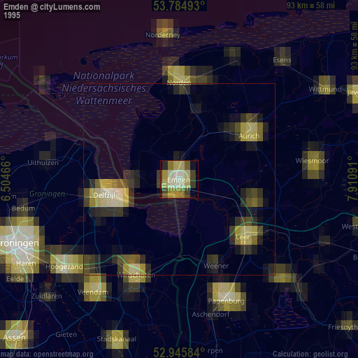
» NASA, Earths city lights 1995
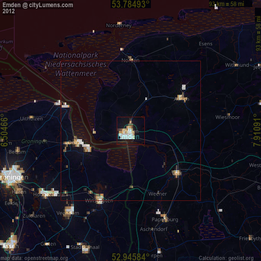
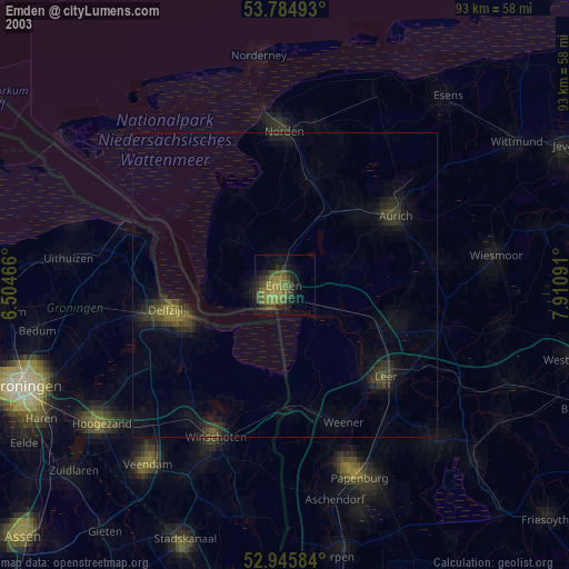
» NASA city lights 2003
» Earth at Night: Flat Maps 2012, 2016