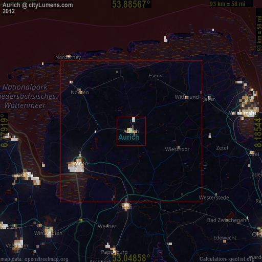
Aurich night lights from space
Night Light of Aurich (Lower Saxony) from space (Germany) Src. Average luminocity for 10x10km area is 7.9114% and for 50x50km: 1.9094%.
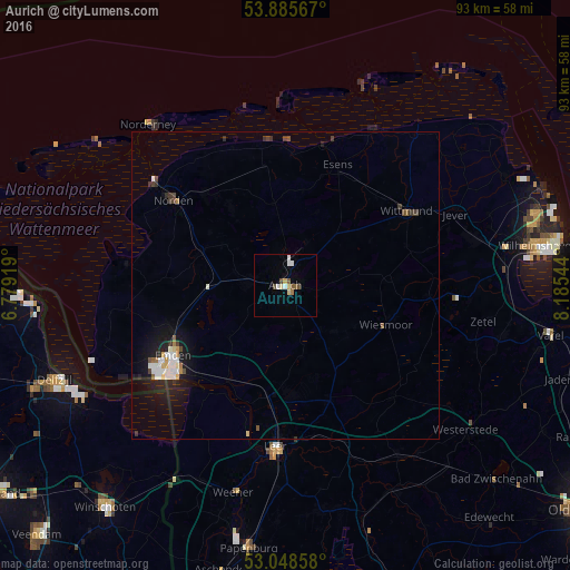
Analysis of Aurich night lights 2016
Square area 10x10 km:
 1.06%
1.06%90-99
1.59%80-89
1.06%70-79
1.06%60-69
0.53%50-59
1.59%40-49
1.59%30-39
0%20-29
0%10-19
0.13%0-9
91.4%Square area 50x50 km:
0.39%90-99
0.34%80-89
0.15%70-79
0.13%60-69
0.13%50-59
0.19%40-49
0.26%30-39
0.27%20-29
0.28%10-19
1.65%0-9
96.21%Clear (daylight) street map image can be seen on geolist.org.
Map coordinates:
53° 53' 8.4" North, 6° 46' 45.1" East
53° 28' 9.1" North, 7° 28' 56.4" East
53° 2' 54.9" North, 8° 11' 7.6" East
Some cities around Aurich sort by population:
• Emden
21.4 km =13.3 mi,  238°
238°
• Norden
23 km =14.3 mi,  307°
307°
• Wittmund
22.9 km =14.2 mi,  58°
58°
• Mittegroßefehn
10.3 km =6.4 mi,  147°
147°
• Wiesmoor
17.6 km =10.9 mi,  109°
109°
• Hinte
20.6 km =12.8 mi,  253°
253°
• Esens
21.7 km =13.5 mi,  23°
23°
• Hage
19.7 km =12.2 mi,  318°
318°
2954006 (p: 40,319)
Sources (retrieved 2019-11-25):
» Earth at Night: Flat Maps 2012, 2016