Hinte night lights from space
Night Light of Hinte (Lower Saxony) from space (Germany) Src. Average luminocity for 10x10km area is 6.1587% and for 50x50km: 3.2826%.
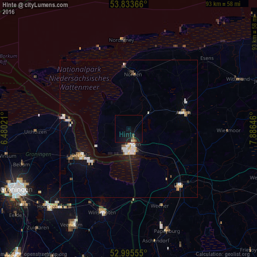
Analysis of Hinte night lights 2016
Square area 10x10 km:
 0%
0%90-99
0.53%80-89
0.53%70-79
0.53%60-69
0.53%50-59
0.53%40-49
0.66%30-39
0.93%20-29
1.06%10-19
13.76%0-9
80.95%Square area 50x50 km:
0.66%90-99
0.59%80-89
0.24%70-79
0.33%60-69
0.24%50-59
0.39%40-49
0.37%30-39
0.2%20-29
0.34%10-19
2.42%0-9
94.22%Clear (daylight) street map image can be seen on geolist.org.
Map coordinates:
53° 50' 1.2" North, 6° 28' 48.8" East
53° 25' 0" North, 7° 10' 60" East
52° 59' 44" North, 7° 53' 11.3" East
Some cities around Hinte sort by population:
• Emden
5.7 km =3.5 mi,  163°
163°
• Aurich
20.6 km =12.8 mi,  73°
73°
• Delfzijl, NL
20.1 km =12.5 mi,  241°
241°
• Norden
19.9 km =12.4 mi,  4°
4°
• Mittegroßefehn
25.5 km =15.8 mi,  96°
96°
• Appingedam, NL
24 km =14.9 mi, 243°
• Bunde
26.5 km =16.5 mi,  167°
167°
• Hage
21.8 km =13.5 mi,  18°
18°
2904397 (p: 7,264)
Sources (retrieved 2019-11-25):
» Earth at Night: Flat Maps 2012, 2016