Eltmann night lights from space
Night Light of Eltmann (Bavaria) from space (Germany) Src. Average luminocity for 10x10km area is 3.4216% and for 50x50km: 2.8027%.
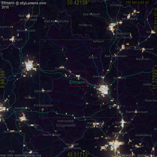
Analysis of Eltmann night lights 2016
Square area 10x10 km:
 0.42%
0.42%90-99
0.98%80-89
0.28%70-79
0.56%60-69
0%50-59
0.56%40-49
1.12%30-39
0%20-29
0%10-19
0.56%0-9
95.52%Square area 50x50 km:
0.46%90-99
0.49%80-89
0.2%70-79
0.21%60-69
0.31%50-59
0.37%40-49
0.44%30-39
0.29%20-29
0.73%10-19
2.36%0-9
94.14%Clear (daylight) street map image can be seen on geolist.org.
Map coordinates:
50° 25' 17.7" North, 9° 57' 50.4" East
49° 58' 17.3" North, 10° 40' 1.6" East
49° 31' 1.7" North, 11° 22' 12.9" East
Some cities around Eltmann sort by population:
• Bamberg
18.6 km =11.6 mi,  115°
115°
• Haßfurt
12.9 km =8 mi,  303°
303°
• Hallstadt
15.6 km =9.7 mi,  107°
107°
• Stegaurach
17.3 km =10.7 mi,  132°
132°
• Knetzgau
8.5 km =5.3 mi,  278°
278°
• Burgebrach
16.8 km =10.4 mi,  161°
161°
• Zeil
6.7 km =4.2 mi,  309°
309°
• Bischberg
13.6 km =8.5 mi, 119°
2930650 (p: 5,614)
Sources (retrieved 2019-11-25):
» Earth at Night: Flat Maps 2012, 2016