Dissen night lights from space
Night Light of Dissen (Lower Saxony) from space (Germany) Src. Average luminocity for 10x10km area is 6.5516% and for 50x50km: 6.6906%.
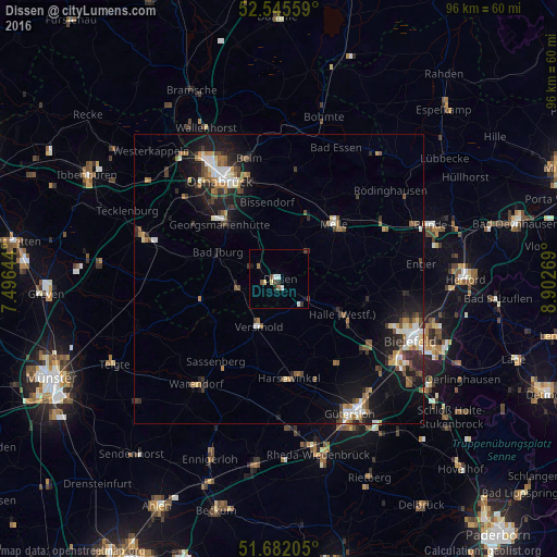
Analysis of Dissen night lights 2016
Square area 10x10 km:
 0.66%
0.66%90-99
1.46%80-89
1.06%70-79
0%60-69
0.79%50-59
0.79%40-49
1.19%30-39
1.19%20-29
1.06%10-19
0.79%0-9
91.01%Square area 50x50 km:
0.82%90-99
1.02%80-89
0.61%70-79
0.56%60-69
1.09%50-59
0.92%40-49
1.07%30-39
1.02%20-29
1.87%10-19
5.17%0-9
85.84%Clear (daylight) street map image can be seen on geolist.org.
Map coordinates:
52° 32' 44.1" North, 7° 29' 47.2" East
52° 6' 57.3" North, 8° 11' 58.4" East
51° 40' 55.4" North, 8° 54' 9.7" East
Some cities around Dissen sort by population:
• Halle
12.6 km =7.8 mi,  119°
119°
• Versmold
9 km =5.6 mi,  200°
200°
• Bissendorf
13.2 km =8.2 mi,  350°
350°
• Bad Iburg
11.6 km =7.2 mi,  291°
291°
• Hilter
4.2 km =2.6 mi,  301°
301°
• Bad Laer
8.1 km =5 mi,  257°
257°
• Borgholzhausen
7.1 km =4.4 mi,  101°
101°
• Bad Rothenfelde
2.2 km =1.4 mi,  272°
272°
2936787 (p: 9,265)
Sources (retrieved 2019-11-25):
» Earth at Night: Flat Maps 2012, 2016