Daun night lights from space
Night Light of Daun (Rheinland-Pfalz) from space (Germany) Src. Average luminocity for 10x10km area is 2.2219% and for 50x50km: 1.3028%.
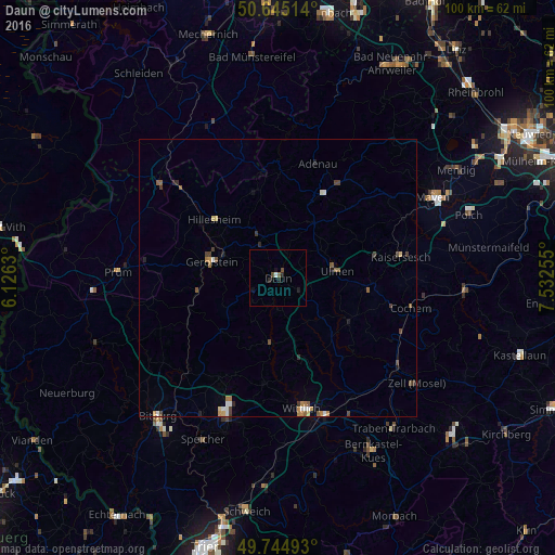
Analysis of Daun night lights 2016
Square area 10x10 km:
 0%
0%90-99
0.53%80-89
0%70-79
0%60-69
0%50-59
0.53%40-49
1.07%30-39
0%20-29
1.6%10-19
1.87%0-9
94.39%Square area 50x50 km:
0.15%90-99
0.15%80-89
0.12%70-79
0.15%60-69
0.23%50-59
0.3%40-49
0.26%30-39
0.24%20-29
0.22%10-19
0.2%0-9
97.98%Clear (daylight) street map image can be seen on geolist.org.
Map coordinates:
50° 38' 42.5" North, 6° 7' 34.7" East
50° 11' 49.8" North, 6° 49' 45.9" East
49° 44' 41.7" North, 7° 31' 57.2" East
Some cities around Daun sort by population:
• Mayen
31.5 km =19.6 mi,  62°
62°
• Wittlich
23.9 km =14.9 mi,  169°
169°
• Bitburg
33.4 km =20.8 mi,  220°
220°
• Blankenheim
29.2 km =18.1 mi,  334°
334°
• Gerolstein
12.4 km =7.7 mi,  283°
283°
• Traben-Trarbach
34.2 km =21.3 mi,  143°
143°
• Prüm
29.1 km =18.1 mi,  272°
272°
• Cochem
24.5 km =15.2 mi,  103°
103°
2938714 (p: 8,523)
Sources (retrieved 2019-11-25):
» Earth at Night: Flat Maps 2012, 2016