Cunewalde night lights from space
Night Light of Cunewalde (Saxony) from space (Germany) Src. Average luminocity for 10x10km area is 0.1564% and for 50x50km: 2.3125%.
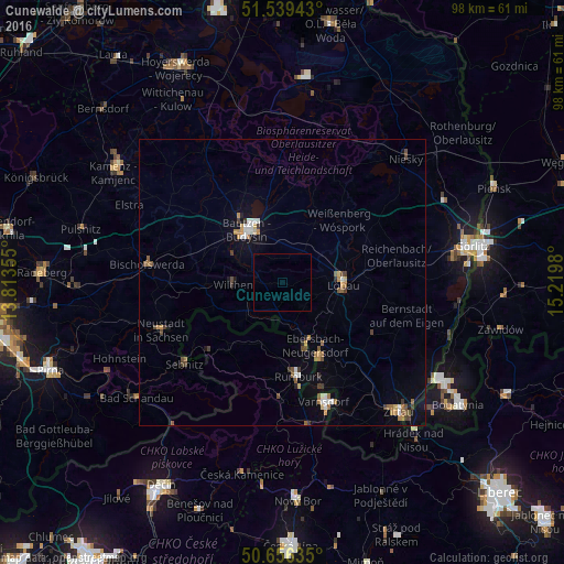
Analysis of Cunewalde night lights 2016
Square area 10x10 km:
 0%
0%90-99
0%80-89
0%70-79
0%60-69
0%50-59
0%40-49
0%30-39
0%20-29
0%10-19
0%0-9
100%Square area 50x50 km:
0.19%90-99
0.34%80-89
0.13%70-79
0.3%60-69
0.43%50-59
0.39%40-49
0.38%30-39
0.39%20-29
0.15%10-19
0.64%0-9
96.66%Clear (daylight) street map image can be seen on geolist.org.
Map coordinates:
51° 32' 21.9" North, 13° 48' 48.8" East
51° 6' 0" North, 14° 31' 0" East
50° 39' 22.9" North, 15° 13' 11.3" East
Some cities around Cunewalde sort by population:
• Bautzen
10.6 km =6.6 mi,  327°
327°
• Löbau
10.5 km =6.5 mi,  90°
90°
• Ebersbach
11.4 km =7.1 mi,  154°
154°
• Sohland
9.5 km =5.9 mi,  226°
226°
• Wilthen
8.6 km =5.3 mi,  268°
268°
• Neugersdorf
15.1 km =9.4 mi, 154°
• Šluknov, CZ
11.6 km =7.2 mi,  202°
202°
• Neukirch/Lausitz
14.6 km =9.1 mi, 268°
2939687 (p: 5,601)
Sources (retrieved 2019-11-25):
» Earth at Night: Flat Maps 2012, 2016