Burglengenfeld night lights from space
Night Light of Burglengenfeld (Bavaria) from space (Germany) Src. Average luminocity for 10x10km area is 9.7269% and for 50x50km: 4.6987%.
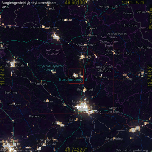
Analysis of Burglengenfeld night lights 2016
Square area 10x10 km:
 0.28%
0.28%90-99
1.4%80-89
0.56%70-79
1.68%60-69
1.54%50-59
2.1%40-49
4.06%30-39
0.14%20-29
1.4%10-19
0%0-9
86.83%Square area 50x50 km:
0.89%90-99
0.99%80-89
0.35%70-79
0.44%60-69
0.46%50-59
0.48%40-49
0.78%30-39
0.44%20-29
1.3%10-19
2.16%0-9
91.7%Clear (daylight) street map image can be seen on geolist.org.
Map coordinates:
49° 39' 39.8" North, 11° 20' 29" East
49° 12' 13.6" North, 12° 2' 40.3" East
48° 44' 32.1" North, 12° 44' 51.5" East
Some cities around Burglengenfeld sort by population:
• Schwandorf in Bayern
14.3 km =8.9 mi,  19°
19°
• Regenstauf
11.2 km =7 mi,  146°
146°
• Lappersdorf
17.8 km =11.1 mi,  168°
168°
• Maxhütte-Haidhof
3.5 km =2.2 mi,  97°
97°
• Nittenau
16.2 km =10.1 mi,  93°
93°
• Wenzenbach
18.2 km =11.3 mi,  141°
141°
• Teublitz
3.8 km =2.4 mi,  55°
55°
• Zeitlarn
14.8 km =9.2 mi,  160°
160°
2941190 (p: 12,095)
Sources (retrieved 2019-11-25):
» Earth at Night: Flat Maps 2012, 2016