Bruckmühl night lights from space
Night Light of Bruckmühl (Bavaria) from space (Germany) Src. Average luminocity for 10x10km area is 3.5682% and for 50x50km: 4.7832%.
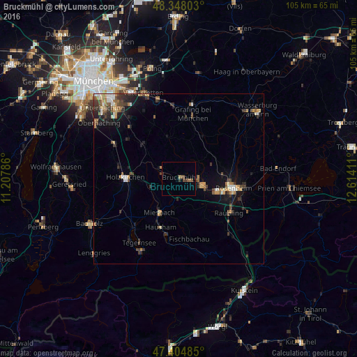
Analysis of Bruckmühl night lights 2016
Square area 10x10 km:
 0%
0%90-99
0%80-89
0%70-79
0.57%60-69
0.43%50-59
1.85%40-49
1.14%30-39
1.14%20-29
0.57%10-19
0%0-9
94.32%Square area 50x50 km:
0.38%90-99
0.65%80-89
0.44%70-79
0.59%60-69
0.79%50-59
0.69%40-49
0.85%30-39
1.14%20-29
1.1%10-19
3.2%0-9
90.17%Clear (daylight) street map image can be seen on geolist.org.
Map coordinates:
48° 20' 52.9" North, 11° 12' 28.3" East
47° 52' 42.9" North, 11° 54' 39.5" East
47° 24' 17.5" North, 12° 36' 50.8" East
Some cities around Bruckmühl sort by population:
• Kolbermoor
12.1 km =7.5 mi,  105°
105°
• Bad Aibling
7.6 km =4.7 mi,  102°
102°
• Miesbach
11.5 km =7.1 mi,  210°
210°
• Feldkirchen-Westerham
6 km =3.7 mi,  302°
302°
• Hausham
15.6 km =9.7 mi,  199°
199°
• Bad Feilnbach
13.8 km =8.6 mi,  147°
147°
• Großkarolinenfeld
12.8 km =8 mi,  83°
83°
• Tuntenhausen
10 km =6.2 mi,  51°
51°
2943408 (p: 15,851)
Sources (retrieved 2019-11-25):
» Earth at Night: Flat Maps 2012, 2016