Wetzlar night lights from space
Night Light of Wetzlar (Hesse) from space (Germany) Src. Average luminocity for 10x10km area is 18.0575% and for 50x50km: 4.0199%.
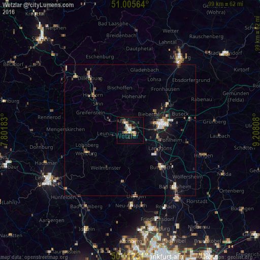
Analysis of Wetzlar night lights 2016
Square area 10x10 km:
 2.94%
2.94%90-99
2.94%80-89
1.2%70-79
1.6%60-69
3.21%50-59
2.27%40-49
2.14%30-39
2.41%20-29
1.07%10-19
15.78%0-9
64.44%Square area 50x50 km:
0.51%90-99
0.55%80-89
0.39%70-79
0.39%60-69
0.56%50-59
0.38%40-49
0.66%30-39
0.57%20-29
0.56%10-19
2.93%0-9
92.51%Clear (daylight) street map image can be seen on geolist.org.
Map coordinates:
51° 0' 20.3" North, 7° 48' 6.6" East
50° 33' 39.9" North, 8° 30' 17.8" East
50° 6' 44.3" North, 9° 12' 29.1" East
Some cities around Wetzlar sort by population:
• Gießen
12.4 km =7.7 mi,  76°
76°
• Aßlar
4.5 km =2.8 mi,  318°
318°
• Solms
7.5 km =4.7 mi,  248°
248°
• Braunfels
9.6 km =6 mi,  238°
238°
• Ehringshausen
9.6 km =6 mi,  296°
296°
• Heuchelheim
9.4 km =5.8 mi,  74°
74°
• Schöffengrund
7.9 km =4.9 mi,  197°
197°
• Leun
10.4 km =6.5 mi,  263°
263°
2809889 (p: 52,656)
Sources (retrieved 2019-11-25):
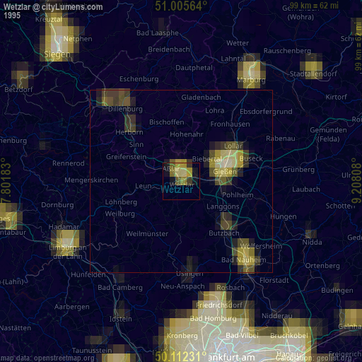
» NASA, Earths city lights 1995
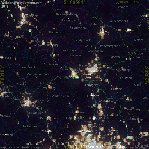
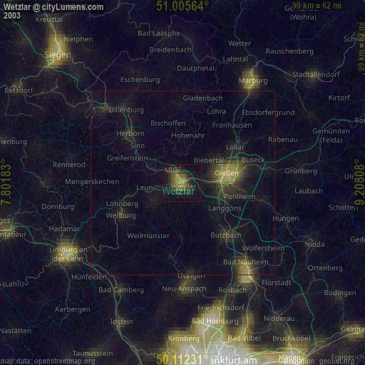
» NASA city lights 2003
» Earth at Night: Flat Maps 2012, 2016