Bodenkirchen night lights from space
Night Light of Bodenkirchen (Bavaria) from space (Germany) Src. Average luminocity for 10x10km area is 0.7045% and for 50x50km: 3.7445%.
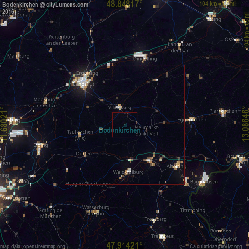
Analysis of Bodenkirchen night lights 2016
Square area 10x10 km:
 0%
0%90-99
0%80-89
0%70-79
0%60-69
0%50-59
0%40-49
0.71%30-39
0.14%20-29
0%10-19
0.57%0-9
98.58%Square area 50x50 km:
0.46%90-99
0.62%80-89
0.34%70-79
0.44%60-69
0.47%50-59
0.38%40-49
0.62%30-39
0.5%20-29
0.7%10-19
2.11%0-9
93.36%Clear (daylight) street map image can be seen on geolist.org.
Map coordinates:
48° 50' 53.4" North, 11° 40' 48.8" East
48° 22' 60" North, 12° 22' 60" East
47° 54' 51.2" North, 13° 5' 11.3" East
Some cities around Bodenkirchen sort by population:
• Mühldorf
18.3 km =11.4 mi,  146°
146°
• Vilsbiburg
8 km =5 mi,  345°
345°
• Gangkofen
14.6 km =9.1 mi,  65°
65°
• Velden
9.6 km =6 mi,  258°
258°
• Geisenhausen
13.8 km =8.6 mi,  318°
318°
• Neumarkt-Sankt Veit
9.5 km =5.9 mi,  105°
105°
• Ampfing
14.6 km =9.1 mi,  170°
170°
• Rohrbach
16.5 km =10.3 mi,  129°
129°
2947125 (p: 5,442)
Sources (retrieved 2019-11-25):
» Earth at Night: Flat Maps 2012, 2016