Amöneburg night lights from space
Night Light of Amöneburg (Hesse) from space (Germany) Src. Average luminocity for 10x10km area is 1.437% and for 50x50km: 2.2943%.
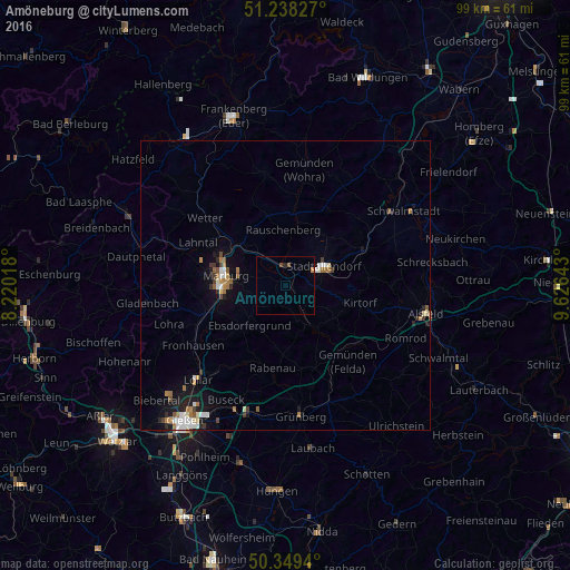
Analysis of Amöneburg night lights 2016
Square area 10x10 km:
 0%
0%90-99
0%80-89
0%70-79
0.56%60-69
0%50-59
0%40-49
1.12%30-39
0%20-29
0.56%10-19
0%0-9
97.76%Square area 50x50 km:
0.34%90-99
0.36%80-89
0.18%70-79
0.18%60-69
0.53%50-59
0.25%40-49
0.22%30-39
0.28%20-29
0.26%10-19
1.6%0-9
95.78%Clear (daylight) street map image can be seen on geolist.org.
Map coordinates:
51° 14' 17.8" North, 8° 13' 12.6" East
50° 47' 45.4" North, 8° 55' 23.9" East
50° 20' 57.8" North, 9° 37' 35.1" East
Some cities around Amöneburg sort by population:
• Marburg an der Lahn
10.8 km =6.7 mi,  277°
277°
• Stadtallendorf
7 km =4.3 mi,  64°
64°
• Kirchhain
3.5 km =2.2 mi,  5°
5°
• Wetter
18.4 km =11.4 mi,  310°
310°
• Neustadt (Hessen)
14.9 km =9.3 mi,  66°
66°
• Homberg
8.9 km =5.5 mi,  144°
144°
• Cölbe
11.7 km =7.3 mi,  301°
301°
• Rabenau
13.8 km =8.6 mi,  197°
197°
2956404 (p: 5,390)
Sources (retrieved 2019-11-25):
» Earth at Night: Flat Maps 2012, 2016