Zlín night lights from space
Night Light of Zlín from space (Czech Republic) Src. Average luminocity for 10x10km area is 25.742% and for 50x50km: 6.1553%.

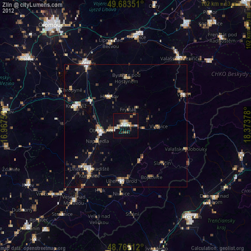
Analysis of Zlín night lights 2016
Square area 10x10 km:
 4.55%
4.55%90-99
4.68%80-89
2.27%70-79
2.41%60-69
3.07%50-59
3.88%40-49
1.07%30-39
1.07%20-29
2.41%10-19
39.57%0-9
35.03%Square area 50x50 km:
0.86%90-99
0.97%80-89
0.45%70-79
0.67%60-69
0.54%50-59
0.7%40-49
0.83%30-39
0.97%20-29
0.57%10-19
5.14%0-9
88.31%Clear (daylight) street map image can be seen on geolist.org.
Map coordinates:
49° 41' 0.6" North, 16° 58' 3.1" East
49° 13' 35.2" North, 17° 40' 14.3" East
48° 45' 54.4" North, 18° 22' 25.6" East
Some cities around Zlín sort by population:
• Kroměříž
21.6 km =13.4 mi,  291°
291°
• Otrokovice
9.7 km =6 mi,  258°
258°
• Holešov
13.6 km =8.5 mi,  330°
330°
• Bystřice pod Hostýnem
19.2 km =11.9 mi,  0°
0°
• Napajedla
13 km =8.1 mi,  242°
242°
• Hulín
18.1 km =11.2 mi,  303°
303°
• Slavičín
21.3 km =13.2 mi,  136°
136°
• Luhačovice
15.4 km =9.6 mi,  155°
155°
3061370 (p: 78,759)
Sources (retrieved 2019-11-25):
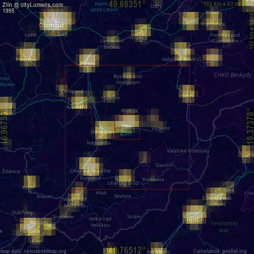
» NASA, Earths city lights 1995
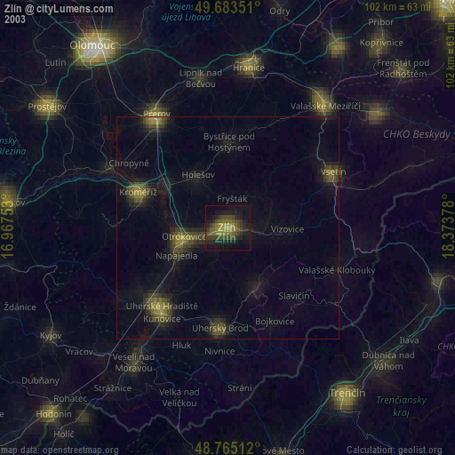
» NASA city lights 2003
» Earth at Night: Flat Maps 2012, 2016