Hulín night lights from space
Night Light of Hulín (Zlín) from space (Czech Republic) Src. Average luminocity for 10x10km area is 10.9385% and for 50x50km: 6.3297%.
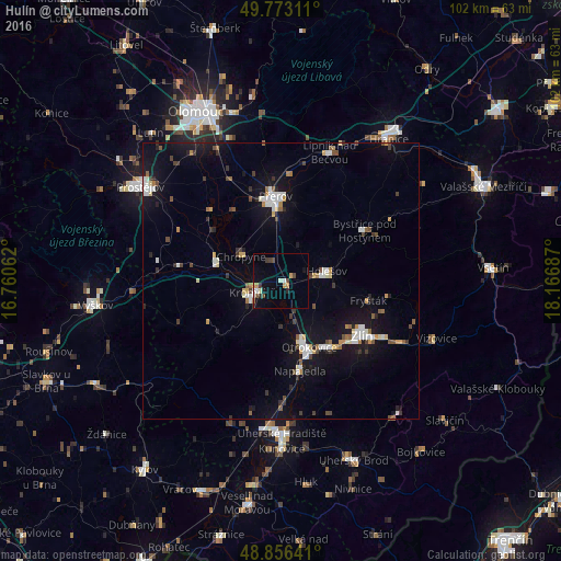
Analysis of Hulín night lights 2016
Square area 10x10 km:
 1.34%
1.34%90-99
1.34%80-89
0.53%70-79
2.54%60-69
0.67%50-59
0.53%40-49
2.14%30-39
2.14%20-29
1.07%10-19
2.54%0-9
85.16%Square area 50x50 km:
0.88%90-99
1.04%80-89
0.48%70-79
0.6%60-69
0.49%50-59
0.6%40-49
0.78%30-39
0.86%20-29
0.79%10-19
5.99%0-9
87.51%Clear (daylight) street map image can be seen on geolist.org.
Map coordinates:
49° 46' 23.2" North, 16° 45' 38.2" East
49° 19' 0.8" North, 17° 27' 49.5" East
48° 51' 23.1" North, 18° 10' 0.7" East
Some cities around Hulín sort by population:
• Přerov
15.4 km =9.6 mi,  356°
356°
• Kroměříž
5.5 km =3.4 mi,  247°
247°
• Otrokovice
13.2 km =8.2 mi,  155°
155°
• Holešov
8.5 km =5.3 mi,  77°
77°
• Bystřice pod Hostýnem
17.8 km =11.1 mi,  58°
58°
• Napajedla
16.5 km =10.3 mi,  167°
167°
• Kojetín
12.3 km =7.6 mi,  288°
288°
• Chropyně
8.4 km =5.2 mi,  301°
301°
3074731 (p: 7,571)
Sources (retrieved 2019-11-25):
» Earth at Night: Flat Maps 2012, 2016