Slavičín night lights from space
Night Light of Slavičín (Zlín) from space (Czech Republic) Src. Average luminocity for 10x10km area is 1.9566% and for 50x50km: 4.6744%.
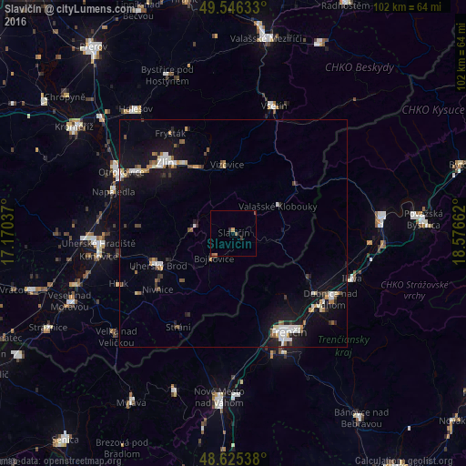
Analysis of Slavičín night lights 2016
Square area 10x10 km:
 0%
0%90-99
0%80-89
0%70-79
0.56%60-69
0.56%50-59
0.56%40-49
0.56%30-39
1.4%20-29
0%10-19
0%0-9
96.36%Square area 50x50 km:
0.77%90-99
0.73%80-89
0.32%70-79
0.47%60-69
0.43%50-59
0.6%40-49
0.5%30-39
0.54%20-29
0.6%10-19
4.78%0-9
90.27%Clear (daylight) street map image can be seen on geolist.org.
Map coordinates:
49° 32' 46.8" North, 17° 10' 13.3" East
49° 5' 16.8" North, 17° 52' 24.6" East
48° 37' 31.4" North, 18° 34' 35.8" East
Some cities around Slavičín sort by population:
• Zlín
21.3 km =13.2 mi,  316°
316°
• Trenčín, SK
24.9 km =15.5 mi,  149°
149°
• Dubnica nad Váhom, SK
25.7 km =16 mi,  123°
123°
• Uherský Brod
17.9 km =11.1 mi,  247°
247°
• Nová Dubnica, SK
26.2 km =16.3 mi,  130°
130°
• Nemšová, SK
22.4 km =13.9 mi, 126°
• Luhačovice
8.5 km =5.3 mi,  278°
278°
• Valašské Klobouky
11.4 km =7.1 mi,  59°
59°
3065843 (p: 7,079)
Sources (retrieved 2019-11-25):
» Earth at Night: Flat Maps 2012, 2016