Vyškov night lights from space
Night Light of Vyškov (South Moravian) from space (Czech Republic) Src. Average luminocity for 10x10km area is 13.1083% and for 50x50km: 4.9176%.
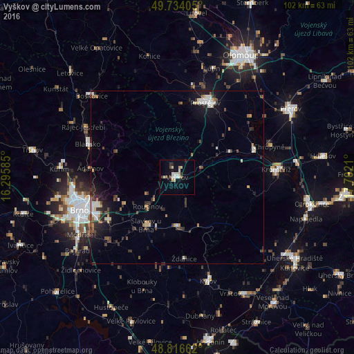
Analysis of Vyškov night lights 2016
Square area 10x10 km:
 1.34%
1.34%90-99
4.81%80-89
0.8%70-79
1.07%60-69
1.07%50-59
0.13%40-49
1.2%30-39
1.34%20-29
1.34%10-19
4.14%0-9
82.75%Square area 50x50 km:
0.61%90-99
0.9%80-89
0.41%70-79
0.42%60-69
0.49%50-59
0.43%40-49
0.78%30-39
0.9%20-29
1.43%10-19
2.93%0-9
90.71%Clear (daylight) street map image can be seen on geolist.org.
Map coordinates:
49° 44' 2.6" North, 16° 17' 45.1" East
49° 16' 38.9" North, 16° 59' 56.3" East
48° 48' 59.8" North, 17° 42' 7.6" East
Some cities around Vyškov sort by population:
• Prostějov
23.1 km =14.4 mi,  20°
20°
• Blansko
27.4 km =17 mi,  290°
290°
• Šlapanice
23.1 km =14.4 mi,  238°
238°
• Kojetín
23.5 km =14.6 mi,  69°
69°
• Bučovice
14.3 km =8.9 mi,  179°
179°
• Slavkov u Brna
16.4 km =10.2 mi,  212°
212°
• Chropyně
27.9 km =17.3 mi, 71°
• Rousínov
12 km =7.5 mi,  225°
225°
3062283 (p: 22,265)
Sources (retrieved 2019-11-25):
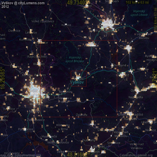
» Earth at Night: Flat Maps 2012, 2016