Valašské Meziříčí night lights from space
Night Light of Valašské Meziříčí (Zlín) from space (Czech Republic) Src. Average luminocity for 10x10km area is 15.0588% and for 50x50km: 3.8023%.
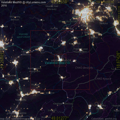
Analysis of Valašské Meziříčí night lights 2016
Square area 10x10 km:
 3.64%
3.64%90-99
3.22%80-89
1.26%70-79
0.42%60-69
1.4%50-59
1.4%40-49
0.98%30-39
1.26%20-29
1.4%10-19
9.66%0-9
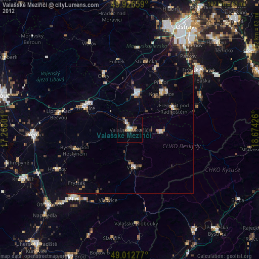
75.35%Square area 50x50 km:
0.5%90-99
0.7%80-89
0.24%70-79
0.32%60-69
0.43%50-59
0.5%40-49
0.39%30-39
0.51%20-29
0.33%10-19
1.78%0-9
94.31%Clear (daylight) street map image can be seen on geolist.org.
Map coordinates:
49° 55' 35.7" North, 17° 16' 4.8" East
49° 28' 18.5" North, 17° 58' 16.1" East
49° 0' 46" North, 18° 40' 27.3" East
Some cities around Valašské Meziříčí sort by population:
• Vsetín
14.9 km =9.3 mi,  173°
173°
• Nový Jičín
13.9 km =8.6 mi,  11°
11°
• Kopřivnice
18.9 km =11.7 mi,  41°
41°
• Hranice
19.1 km =11.9 mi,  296°
296°
• Rožnov pod Radhoštěm
12.5 km =7.8 mi,  96°
96°
• Frenštát pod Radhoštěm
19.3 km =12 mi,  63°
63°
• Příbor
22.6 km =14 mi,  33°
33°
• Zubří
8.8 km =5.5 mi,  94°
94°
3063447 (p: 27,481)
Sources (retrieved 2019-11-25):
» Earth at Night: Flat Maps 2012, 2016