Vsetín night lights from space
Night Light of Vsetín (Zlín) from space (Czech Republic) Src. Average luminocity for 10x10km area is 5.5936% and for 50x50km: 3.2174%.
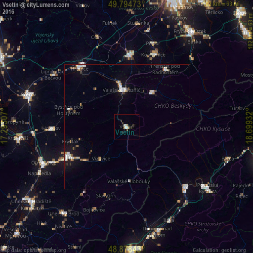
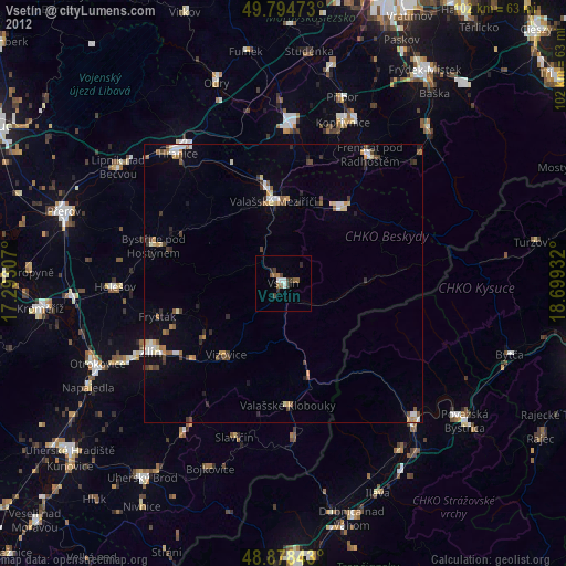
Analysis of Vsetín night lights 2016
Square area 10x10 km:
 1.2%
1.2%90-99
0.94%80-89
0%70-79
0.94%60-69
0.67%50-59
0.53%40-49
0%30-39
1.34%20-29
1.34%10-19
1.6%0-9
91.44%Square area 50x50 km:
0.58%90-99
0.67%80-89
0.17%70-79
0.3%60-69
0.22%50-59
0.46%40-49
0.42%30-39
0.33%20-29
0.3%10-19
1.69%0-9
94.86%Clear (daylight) street map image can be seen on geolist.org.
Map coordinates:
49° 47' 41" North, 17° 17' 35.1" East
49° 20' 19.4" North, 17° 59' 46.3" East
48° 52' 42.3" North, 18° 41' 57.6" East
Some cities around Vsetín sort by population:
• Zlín
26.7 km =16.6 mi,  242°
242°
• Valašské Meziříčí
14.9 km =9.3 mi,  353°
353°
• Nový Jičín
28.4 km =17.6 mi,  2°
2°
• Rožnov pod Radhoštěm
17 km =10.6 mi,  38°
38°
• Frenštát pod Radhoštěm
28 km =17.4 mi,  33°
33°
• Bystřice pod Hostýnem
24.3 km =15.1 mi,  286°
286°
• Zubří
15.8 km =9.8 mi, 26°
• Valašské Klobouky
22 km =13.7 mi,  177°
177°
3062339 (p: 28,575)
Sources (retrieved 2019-11-25):
» Earth at Night: Flat Maps 2012, 2016