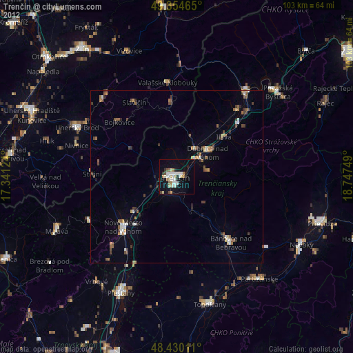
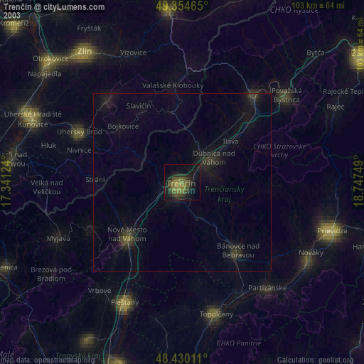
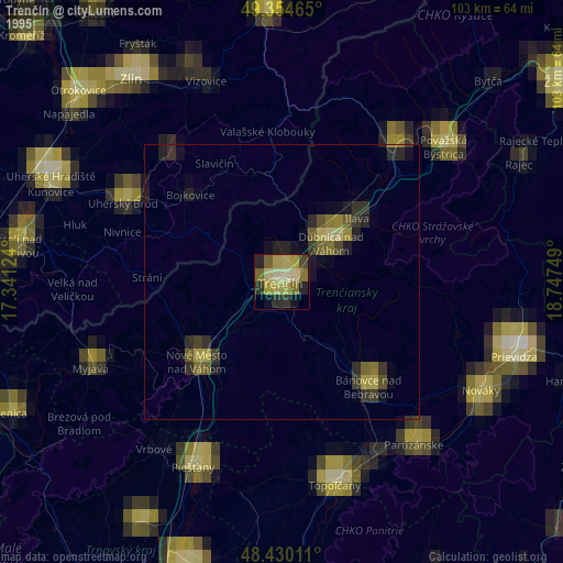
Trenčín night lights from space
Night Light of Trenčín (Trenčiansky kraj) from space (Slovakia) Src. Average luminocity for 10x10km area is 31.5355% and for 50x50km: 3.9469%.

Analysis of Trenčín night lights 2016
Square area 10x10 km:
 8.24%
8.24%90-99
7.67%80-89
1.85%70-79
2.56%60-69
1.42%50-59
3.41%40-49
1.99%30-39
1.28%20-29
3.84%10-19
43.04%0-9
24.72%Square area 50x50 km:
0.72%90-99
0.68%80-89
0.3%70-79
0.28%60-69
0.34%50-59
0.5%40-49
0.37%30-39
0.46%20-29
0.42%10-19
3.22%0-9
92.72%Clear (daylight) street map image can be seen on geolist.org.
Map coordinates:
49° 21' 16.7" North, 17° 20' 28.5" East
48° 53' 40.3" North, 18° 2' 39.7" East
48° 25' 48.4" North, 18° 44' 51" East
Some cities around Trenčín sort by population:
• Dubnica nad Váhom
11.5 km =7.1 mi,  50°
50°
• Nové Mesto nad Váhom
21.8 km =13.5 mi,  225°
225°
• Bánovce nad Bebravou
24.8 km =15.4 mi,  140°
140°
• Nová Dubnica
8.7 km =5.4 mi,  58°
58°
• Slavičín, CZ
24.9 km =15.5 mi,  329°
329°
• Nemšová
9.7 km =6 mi,  34°
34°
• Ilava
18.1 km =11.2 mi, 50°
• Valašské Klobouky, CZ
27.5 km =17.1 mi,  354°
354°
3057140 (p: 58,278)
Sources (retrieved 2019-11-25):
» NASA, Earths city lights 1995
» NASA city lights 2003
» Earth at Night: Flat Maps 2012, 2016