Skuteč night lights from space
Night Light of Skuteč (Pardubický) from space (Czech Republic) Src. Average luminocity for 10x10km area is 1.0668% and for 50x50km: 3.5447%.
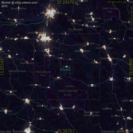
Analysis of Skuteč night lights 2016
Square area 10x10 km:
 0%
0%90-99
0.53%80-89
0%70-79
0.53%60-69
0%50-59
0%40-49
0%30-39
0%20-29
0%10-19
0%0-9
98.93%Square area 50x50 km:
0.72%90-99
0.82%80-89
0.28%70-79
0.42%60-69
0.31%50-59
0.16%40-49
0.42%30-39
0.38%20-29
0.93%10-19
2.06%0-9
93.5%Clear (daylight) street map image can be seen on geolist.org.
Map coordinates:
50° 17' 41.2" North, 15° 17' 36.3" East
49° 50' 36.5" North, 15° 59' 47.6" East
49° 23' 16.5" North, 16° 41' 58.8" East
Some cities around Skuteč sort by population:
• Pardubice
27 km =16.8 mi,  324°
324°
• Chrudim
18.7 km =11.6 mi,  309°
309°
• Vysoké Mýto
17 km =10.6 mi,  44°
44°
• Hlinsko
11.1 km =6.9 mi,  215°
215°
• Litomyšl
22.8 km =14.2 mi,  83°
83°
• Polička
24 km =14.9 mi,  126°
126°
• Choceň
23.9 km =14.9 mi, 42°
• Holice
24.8 km =15.4 mi,  358°
358°
3065921 (p: 5,415)
Sources (retrieved 2019-11-25):
» Earth at Night: Flat Maps 2012, 2016