Sedlčany night lights from space
Night Light of Sedlčany (Central Bohemia) from space (Czech Republic) Src. Average luminocity for 10x10km area is 1.2353% and for 50x50km: 0.9182%.
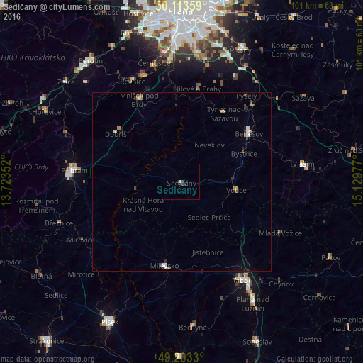
Analysis of Sedlčany night lights 2016
Square area 10x10 km:
 0%
0%90-99
0.53%80-89
0%70-79
0%60-69
0%50-59
0%40-49
0%30-39
0.53%20-29
1.07%10-19
1.6%0-9
96.26%Square area 50x50 km:
0.13%90-99
0.14%80-89
0.08%70-79
0.06%60-69
0.16%50-59
0.06%40-49
0.17%30-39
0.13%20-29
0.21%10-19
0.28%0-9
98.58%Clear (daylight) street map image can be seen on geolist.org.
Map coordinates:
50° 6' 48.9" North, 13° 43' 24.7" East
49° 39' 38.1" North, 14° 25' 35.9" East
49° 12' 11.9" North, 15° 7' 47.2" East
Some cities around Sedlčany sort by population:
• Tábor
32.1 km =19.9 mi,  148°
148°
• Příbram
30.1 km =18.7 mi,  276°
276°
• Benešov
23.1 km =14.4 mi,  54°
54°
• Vlašim
34.3 km =21.3 mi,  81°
81°
• Milevsko
23.8 km =14.8 mi,  191°
191°
• Dobříš
23 km =14.3 mi,  305°
305°
• Sezimovo Ústí
35.8 km =22.2 mi, 148°
• Týnec nad Sázavou
22.5 km =14 mi,  31°
31°
3066333 (p: 7,836)
Sources (retrieved 2019-11-25):
» Earth at Night: Flat Maps 2012, 2016