Roztoky night lights from space
Night Light of Roztoky (Central Bohemia) from space (Czech Republic) Src. Average luminocity for 10x10km area is 45.8396% and for 50x50km: 25.4088%.
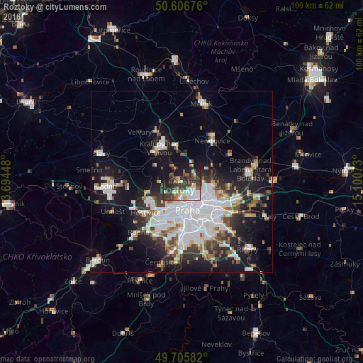
Analysis of Roztoky night lights 2016
Square area 10x10 km:
 10.43%
90-99
6.68%80-89
4.95%70-79
3.88%60-69
5.08%50-59
6.28%40-49
7.22%30-39
15.11%20-29
12.3%10-19
27.27%0-9
0.8%Square area 50x50 km:
8.06%90-99
5.39%80-89
1.66%70-79
1.68%60-69
2.13%50-59
2.33%40-49
2.38%30-39
3.26%20-29
5.3%10-19
15.36%0-9
52.46%Clear (daylight) street map image can be seen on geolist.org.
Map coordinates:
50° 36' 24.3" North, 13° 41' 40.1" East
50° 9' 30.3" North, 14° 23' 51.4" East
49° 42' 21" North, 15° 6' 2.6" East
Some cities around Roztoky sort by population:
• Prague
8 km =5 mi,  168°
168°
• Libeň
7.8 km =4.8 mi,  135°
135°
• Letňany
8.9 km =5.5 mi,  108°
108°
• Prosek
9.1 km =5.7 mi,  121°
121°
• Střížkov
7.7 km =4.8 mi, 117°
• Karlín
8.1 km =5 mi,  154°
154°
• Staré Město
8.1 km =5 mi, 168°
• Malá Strana
7.9 km =4.9 mi,  176°
176°
3066636 (p: 5,956)
Sources (retrieved 2019-11-25):
» Earth at Night: Flat Maps 2012, 2016