Nové Strašecí night lights from space
Night Light of Nové Strašecí (Central Bohemia) from space (Czech Republic) Src. Average luminocity for 10x10km area is 2.3837% and for 50x50km: 4.7842%.
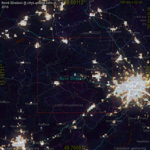
Analysis of Nové Strašecí night lights 2016
Square area 10x10 km:
 0.27%
0.27%90-99
0.27%80-89
0.53%70-79
0%60-69
0.53%50-59
0.53%40-49
1.07%30-39
0%20-29
0%10-19
0%0-9
96.79%Square area 50x50 km:
0.92%90-99
1%80-89
0.24%70-79
0.29%60-69
0.39%50-59
0.35%40-49
0.5%30-39
0.49%20-29
0.89%10-19
4.75%0-9
90.18%Clear (daylight) street map image can be seen on geolist.org.
Map coordinates:
50° 36' 4" North, 13° 11' 50.3" East
50° 9' 9.8" North, 13° 54' 1.5" East
49° 42' 0.3" North, 14° 36' 12.8" East
Some cities around Nové Strašecí sort by population:
• Kladno
14.4 km =8.9 mi,  92°
92°
• Louny
23.9 km =14.9 mi,  342°
342°
• Beroun
24.3 km =15.1 mi,  149°
149°
• Kralupy nad Vltavou
30.9 km =19.2 mi,  71°
71°
• Rakovník
13.1 km =8.1 mi,  245°
245°
• Slaný
15.8 km =9.8 mi,  56°
56°
• Králův Dvůr
24.5 km =15.2 mi,  157°
157°
• Stochov
4.5 km =2.8 mi,  99°
99°
3069431 (p: 5,082)
Sources (retrieved 2019-11-25):
» Earth at Night: Flat Maps 2012, 2016