Louny night lights from space
Night Light of Louny (Ústecký kraj) from space (Czech Republic) Src. Average luminocity for 10x10km area is 13.056% and for 50x50km: 6.4588%.
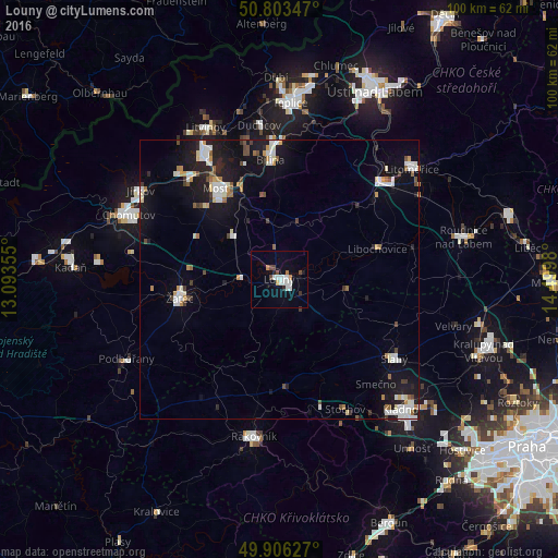
Analysis of Louny night lights 2016
Square area 10x10 km:
 3.78%
3.78%90-99
2.38%80-89
0%70-79
1.12%60-69
1.12%50-59
0.42%40-49
2.38%30-39
0.56%20-29
1.12%10-19
2.94%0-9
84.17%Square area 50x50 km:
1.21%90-99
1.3%80-89
0.46%70-79
0.62%60-69
0.52%50-59
0.4%40-49
0.78%30-39
0.43%20-29
1.07%10-19
5.88%0-9
87.35%Clear (daylight) street map image can be seen on geolist.org.
Map coordinates:
50° 48' 12.5" North, 13° 5' 36.8" East
50° 21' 25.2" North, 13° 47' 48" East
49° 54' 22.6" North, 14° 29' 59.3" East
Some cities around Louny sort by population:
• Most
19.8 km =12.3 mi,  325°
325°
• Žatec
18.1 km =11.2 mi,  259°
259°
• Bílina
21.4 km =13.3 mi,  355°
355°
• Bílina Kyselka
21.6 km =13.4 mi,  354°
354°
• Slaný
25 km =15.5 mi,  124°
124°
• Lovosice
25.2 km =15.7 mi,  45°
45°
• Stochov
26.3 km =16.3 mi,  153°
153°
• Nové Strašecí
23.9 km =14.9 mi,  162°
162°
3071507 (p: 19,147)
Sources (retrieved 2019-11-25):
» Earth at Night: Flat Maps 2012, 2016