Kbely night lights from space
Night Light of Kbely (Hlavní město Praha) from space (Czech Republic) Src. Average luminocity for 10x10km area is 65.3102% and for 50x50km: 24.0567%.
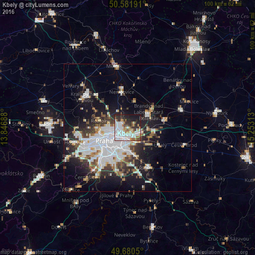
Analysis of Kbely night lights 2016
Square area 10x10 km:
 27.14%
90-99
15.37%80-89
2.41%70-79
6.42%60-69
6.95%50-59
5.21%40-49
2.54%30-39
8.42%20-29
14.04%10-19
11.23%0-9
0.27%Square area 50x50 km:
7.6%90-99
5.02%80-89
1.57%70-79
1.78%60-69
2.09%50-59
2.26%40-49
2.34%30-39
3.27%20-29
5.19%10-19
12.37%0-9
56.51%Clear (daylight) street map image can be seen on geolist.org.
Map coordinates:
50° 34' 54.9" North, 13° 50' 48.8" East
50° 7' 60" North, 14° 33' 0" East
49° 40' 49.8" North, 15° 15' 11.3" East
Some cities around Kbely sort by population:
• Libeň
6.1 km =3.8 mi,  242°
242°
• Černý Most
3.8 km =2.4 mi,  146°
146°
• Letňany
2.4 km =1.5 mi,  270°
270°
• Prosek
3.7 km =2.3 mi, 236°
• Horní Počernice
4.9 km =3 mi,  118°
118°
• Střížkov
4.1 km =2.5 mi,  259°
259°
• Karlín
8.6 km =5.3 mi, 238°
• Vysočany
3.6 km =2.2 mi,  221°
221°
3073743 (p: 5,457)
Sources (retrieved 2019-11-25):
» Earth at Night: Flat Maps 2012, 2016