Karlovy Vary night lights from space
Night Light of Karlovy Vary (Karlovarský kraj) from space (Czech Republic) Src. Average luminocity for 10x10km area is 25.9973% and for 50x50km: 3.5896%.
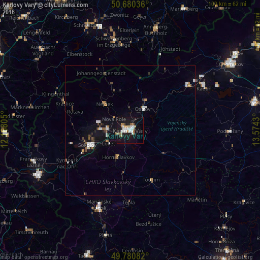
Analysis of Karlovy Vary night lights 2016
Square area 10x10 km:
 6.15%
6.15%90-99
5.61%80-89
2.94%70-79
2.01%60-69
2.41%50-59
1.07%40-49
1.47%30-39
0.53%20-29
1.47%10-19
39.17%0-9
37.17%Square area 50x50 km:
0.64%90-99
0.61%80-89
0.2%70-79
0.29%60-69
0.41%50-59
0.32%40-49
0.41%30-39
0.46%20-29
0.37%10-19
3.16%0-9
93.12%Clear (daylight) street map image can be seen on geolist.org.
Map coordinates:
50° 40' 49.3" North, 12° 10' 5" East
50° 13' 57.8" North, 12° 52' 16.2" East
49° 46' 51" North, 13° 34' 27.5" East
Some cities around Karlovy Vary sort by population:
• Sokolov
17.4 km =10.8 mi,  250°
250°
• Ostrov
9.5 km =5.9 mi,  30°
30°
• Chodov
9 km =5.6 mi,  275°
275°
• Nejdek
14.2 km =8.8 mi,  314°
314°
• Kraslice
27.1 km =16.8 mi,  291°
291°
• Horní Slavkov
11.4 km =7.1 mi,  203°
203°
• Johanngeorgenstadt, DE
24.9 km =15.5 mi,  332°
332°
• Habartov
23.5 km =14.6 mi,  256°
256°
3073803 (p: 51,807)
Sources (retrieved 2019-11-25):
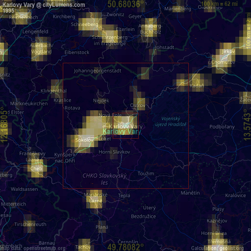
» NASA, Earths city lights 1995
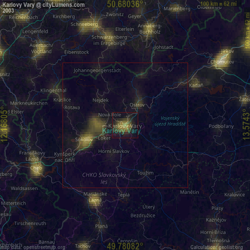
» NASA city lights 2003
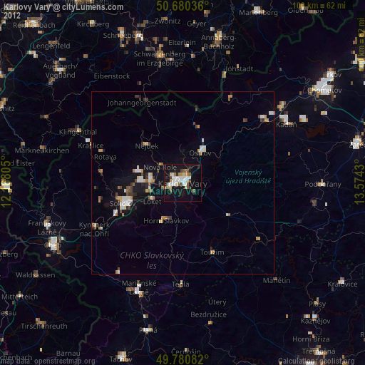
» Earth at Night: Flat Maps 2012, 2016