Ostrov night lights from space
Night Light of Ostrov (Karlovarský kraj) from space (Czech Republic) Src. Average luminocity for 10x10km area is 6.8583% and for 50x50km: 3.8377%.
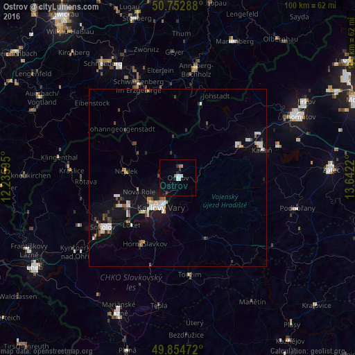
Analysis of Ostrov night lights 2016
Square area 10x10 km:
 1.47%
1.47%90-99
1.2%80-89
0%70-79
0.53%60-69
0.8%50-59
0.27%40-49
0%30-39
1.87%20-29
0.27%10-19
3.88%0-9
89.71%Square area 50x50 km:
0.69%90-99
0.73%80-89
0.18%70-79
0.31%60-69
0.42%50-59
0.32%40-49
0.4%30-39
0.41%20-29
0.37%10-19
3.32%0-9
92.85%Clear (daylight) street map image can be seen on geolist.org.
Map coordinates:
50° 45' 10.4" North, 12° 14' 9.4" East
50° 18' 21.3" North, 12° 56' 20.7" East
49° 51' 17" North, 13° 38' 31.9" East
Some cities around Ostrov sort by population:
• Karlovy Vary
9.5 km =5.9 mi,  210°
210°
• Sokolov
25.4 km =15.8 mi,  236°
236°
• Kadaň
24.8 km =15.4 mi,  69°
69°
• Klášterec nad Ohří
19.6 km =12.2 mi,  62°
62°
• Chodov
15.6 km =9.7 mi, 242°
• Nejdek
15 km =9.3 mi,  277°
277°
• Horní Slavkov
20.8 km =12.9 mi, 206°
• Johanngeorgenstadt, DE
21.4 km =13.3 mi,  311°
311°
3068766 (p: 17,206)
Sources (retrieved 2019-11-25):
» Earth at Night: Flat Maps 2012, 2016