Bílovec night lights from space
Night Light of Bílovec (Moravskoslezský) from space (Czech Republic) Src. Average luminocity for 10x10km area is 3.393% and for 50x50km: 11.6722%.
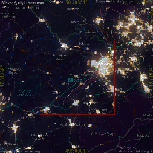
Analysis of Bílovec night lights 2016
Square area 10x10 km:
 0%
0%90-99
0%80-89
0%70-79
0.13%60-69
0.8%50-59
2.01%40-49
0.67%30-39
1.47%20-29
0.8%10-19
1.34%0-9
92.78%Square area 50x50 km:
2.28%90-99
2.3%80-89
0.9%70-79
1.19%60-69
1.44%50-59
1.49%40-49
1.55%30-39
1.52%20-29
2.89%10-19
5.69%0-9
78.75%Clear (daylight) street map image can be seen on geolist.org.
Map coordinates:
50° 12' 30.6" North, 17° 18' 45.7" East
49° 45' 23" North, 18° 0' 56.9" East
49° 18' 0" North, 18° 43' 8.2" East
Some cities around Bílovec sort by population:
• Nový Jičín
18 km =11.2 mi,  181°
181°
• Studénka
5.8 km =3.6 mi,  129°
129°
• Příbor
15.8 km =9.8 mi,  144°
144°
• Odry
16.9 km =10.5 mi,  231°
231°
• Kravaře
19.5 km =12.1 mi,  357°
357°
• Vítkov
19.2 km =11.9 mi,  275°
275°
• Fulnek
9.5 km =5.9 mi,  238°
238°
• Hradec nad Moravici
16.1 km =10 mi,  322°
322°
3079336 (p: 7,486)
Sources (retrieved 2019-11-25):
» Earth at Night: Flat Maps 2012, 2016