Xylofágou night lights from space
Night Light of Xylofágou (Larnaka) from space (Cyprus) Src. Average luminocity for 10x10km area is 27.0201% and for 50x50km: 15.2648%.
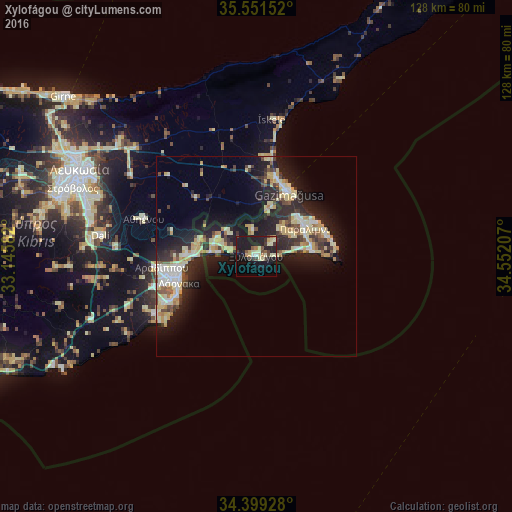
Analysis of Xylofágou night lights 2016
Square area 10x10 km:
 0.55%
0.55%90-99
4.58%80-89
8.06%70-79
1.65%60-69
2.01%50-59
2.75%40-49
2.01%30-39
5.86%20-29
4.03%10-19
41.39%0-9
27.11%Square area 50x50 km:
1.36%90-99
2.91%80-89
3.45%70-79
1.89%60-69
1.15%50-59
1.11%40-49
2.06%30-39
2.04%20-29
5.36%10-19
12.41%0-9
66.26%Clear (daylight) street map image can be seen on geolist.org.
Map coordinates:
35° 33' 5.5" North, 33° 8' 45" East
34° 58' 38.7" North, 33° 50' 56.2" East
34° 23' 57.4" North, 34° 33' 7.5" East
Some cities around Xylofágou sort by population:
• Larnaca
21.4 km =13.3 mi,  253°
253°
• Famagusta
17.9 km =11.1 mi,  27°
27°
• Protaras
19.5 km =12.1 mi,  78°
78°
• Pérgamos
14.7 km =9.1 mi,  299°
299°
• Aradíppou
23.6 km =14.7 mi,  262°
262°
• Paralímni
13.9 km =8.6 mi,  60°
60°
• Livádia
20.5 km =12.7 mi, 261°
• Derýneia
14.1 km =8.8 mi,  46°
46°
145972 (p: 6,000)
Sources (retrieved 2019-11-25):
» Earth at Night: Flat Maps 2012, 2016