Larnaca night lights from space
Night Light of Larnaca (Larnaka) from space (Cyprus) Src. Average luminocity for 10x10km area is 68.8535% and for 50x50km: 17.4517%.
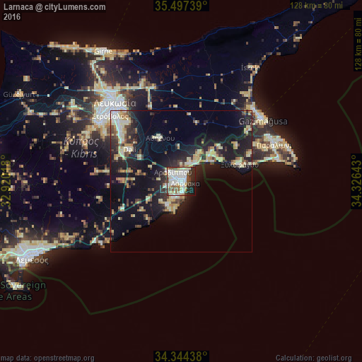
Analysis of Larnaca night lights 2016
Square area 10x10 km:
 18.13%
90-99
25.82%80-89
9.71%70-79
2.2%60-69
3.11%50-59
8.42%40-49
9.16%30-39
4.03%20-29
13%10-19
6.23%0-9
0.18%Square area 50x50 km:
1.53%90-99
3.38%80-89
3.4%70-79
1.96%60-69
1.44%50-59
1.42%40-49
2.41%30-39
2.52%20-29
5.36%10-19
14.92%0-9
61.66%Clear (daylight) street map image can be seen on geolist.org.
Map coordinates:
35° 29' 50.6" North, 32° 55' 12.6" East
34° 55' 22.5" North, 33° 37' 23.9" East
34° 20' 39.8" North, 34° 19' 35.1" East
Some cities around Larnaca sort by population:
• Pérgamos
15.3 km =9.5 mi,  30°
30°
• Aradíppou
4.3 km =2.7 mi,  318°
318°
• Géri
27.5 km =17.1 mi, 317°
• Dáli
21.5 km =13.4 mi,  301°
301°
• Xylofágou
21.4 km =13.3 mi,  73°
73°
• Tséri
32 km =19.9 mi, 301°
• Livádia
3.2 km =2 mi,  5°
5°
• Dhromolaxia
6.2 km =3.9 mi,  212°
212°
146400 (p: 72,000)
Sources (retrieved 2019-11-25):
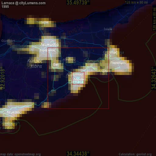
» NASA, Earths city lights 1995
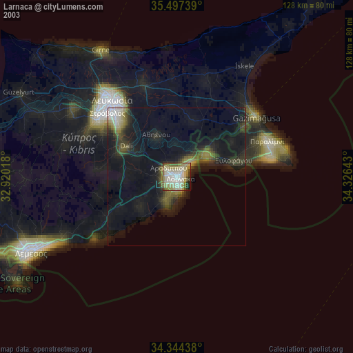
» NASA city lights 2003
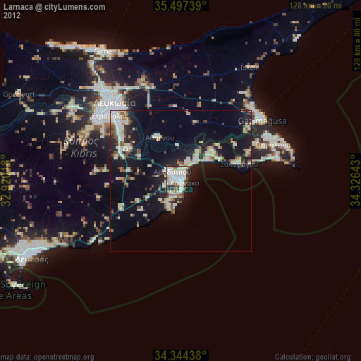
» Earth at Night: Flat Maps 2012, 2016