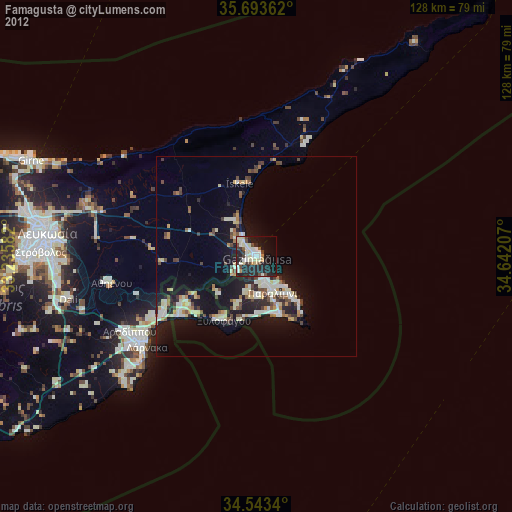
Famagusta night lights from space
Night Light of Famagusta (Ammochostos) from space (Cyprus) Src. Average luminocity for 10x10km area is 39.8217% and for 50x50km: 11.9414%.
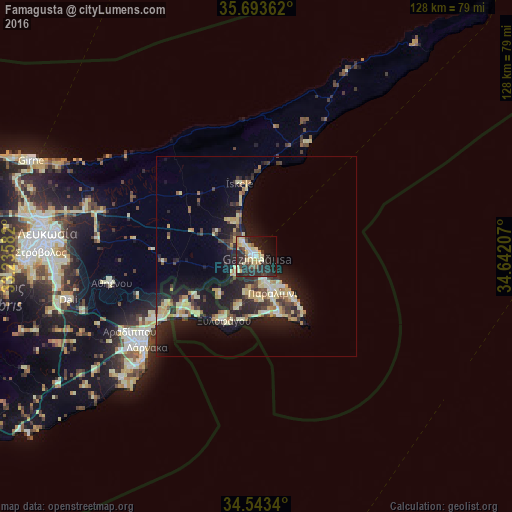
Analysis of Famagusta night lights 2016
Square area 10x10 km:
 4.55%
4.55%90-99
6.82%80-89
9.97%70-79
4.55%60-69
1.57%50-59
2.97%40-49
5.24%30-39
4.72%20-29
29.02%10-19
20.28%0-9
10.31%Square area 50x50 km:
0.62%90-99
1.63%80-89
3%70-79
1.56%60-69
1.01%50-59
0.89%40-49
1.69%30-39
1.82%20-29
4.59%10-19
11.22%0-9
71.96%Clear (daylight) street map image can be seen on geolist.org.
Map coordinates:
35° 41' 37" North, 33° 14' 9" East
35° 7' 13.9" North, 33° 56' 20.2" East
34° 32' 36.2" North, 34° 38' 31.5" East
Some cities around Famagusta sort by population:
• Larnaca
36.2 km =22.5 mi,  232°
232°
• Protaras
16.2 km =10.1 mi,  137°
137°
• Pérgamos
22.7 km =14.1 mi,  247°
247°
• Aradíppou
36.8 km =22.9 mi,  239°
239°
• Paralímni
9.8 km =6.1 mi,  156°
156°
• Xylofágou
17.9 km =11.1 mi,  207°
207°
• Livádia
34.1 km =21.2 mi, 236°
• Derýneia
6.5 km =4 mi, 162°
146617 (p: 42,526)
Sources (retrieved 2019-11-25):
» Earth at Night: Flat Maps 2012, 2016