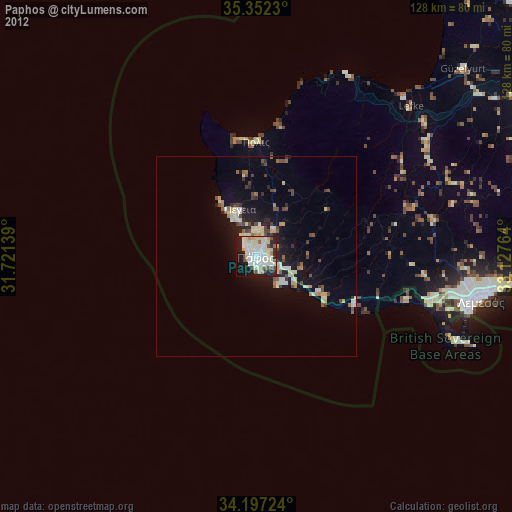
Paphos night lights from space
Night Light of Paphos (Pafos) from space (Cyprus) Src. Average luminocity for 10x10km area is 63.5165% and for 50x50km: 7.5729%.
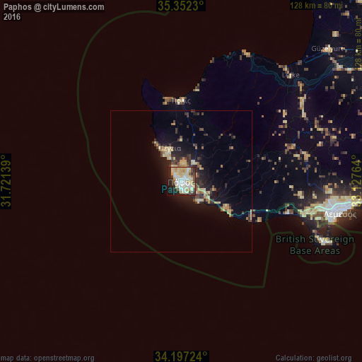
Analysis of Paphos night lights 2016
Square area 10x10 km:
100  12.45%
90-99 17.95%
80-89 16.67%
70-79 8.61%
60-69 2.75%
50-59 3.3%
40-49 6.78%
30-39 3.66%
20-29 15.75%
10-19 10.81%
0-9 1.28%
12.45%90-99
17.95%80-89
16.67%70-79
8.61%60-69
2.75%50-59
3.3%40-49
6.78%30-39
3.66%20-29
15.75%10-19
10.81%0-9
1.28%Square area 50x50 km:
100 0.5%
90-99 1.08%
80-89 1.7%
70-79 0.99%
60-69 0.65%
50-59 0.67%
40-49 1.22%
30-39 1.51%
20-29 2.48%
10-19 5.39%
0-9 83.81%
0.5%90-99
1.08%80-89
1.7%70-79
0.99%60-69
0.65%50-59
0.67%40-49
1.22%30-39
1.51%20-29
2.48%10-19
5.39%0-9
83.81%Clear (daylight) street map image can be seen on geolist.org.
Map coordinates:
35° 21' 8.3" North, 31° 43' 17" East
34° 46' 36.4" North, 32° 25' 28.2" East
34° 11' 50.1" North, 33° 7' 39.5" East
Some cities around Paphos sort by population:
• Limassol
57 km =35.4 mi,  100°
100°
• Mórfou
69.9 km =43.4 mi,  47°
47°
• Geroskipou
3.5 km =2.2 mi,  134°
134°
• Léfka
53.8 km =33.4 mi, 46°
• Ýpsonas
50.1 km =31.1 mi, 101°
• Dáli
95 km =59 mi,  73°
73°
• Tséri
88.3 km =54.9 mi, 68°
• Lápithos
92.4 km =57.4 mi, 47°
146214 (p: 35,961)
Sources (retrieved 2019-11-25):
» Earth at Night: Flat Maps 2012, 2016