Río Cauto night lights from space
Night Light of Río Cauto (Granma) from space (Cuba) Src. Average luminocity for 10x10km area is 4.5587% and for 50x50km: 2.2181%.
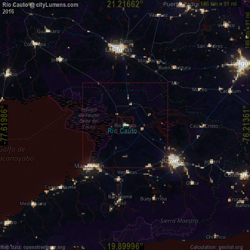
Analysis of Río Cauto night lights 2016
Square area 10x10 km:
 0.38%
0.38%90-99
0.76%80-89
0.38%70-79
0.76%60-69
0%50-59
1.14%40-49
0.38%30-39
0.76%20-29
2.65%10-19
0.38%0-9
92.42%Square area 50x50 km:
0.18%90-99
0.34%80-89
0.29%70-79
0.22%60-69
0.18%50-59
0.25%40-49
0.44%30-39
0.39%20-29
0.46%10-19
2.08%0-9
95.17%Clear (daylight) street map image can be seen on geolist.org.
Map coordinates:
21° 12' 59.8" North, 77° 37' 11.5" West
20° 33' 35" North, 76° 55' 0.2" West
19° 53' 59.9" North, 76° 12' 49" West
Some cities around Río Cauto sort by population:
• Las Tunas
44.8 km =27.8 mi,  355°
355°
• Bayamo
35.1 km =21.8 mi,  125°
125°
• Manzanillo
32.3 km =20.1 mi,  221°
221°
• Bartolomé Masó
43.8 km =27.2 mi,  183°
183°
• Yara
31.9 km =19.8 mi,  186°
186°
• Campechuela
52.4 km =32.6 mi,  226°
226°
• Cauto Cristo
46.2 km =28.7 mi,  90°
90°
• Guisa
51.9 km =32.2 mi, 130°
3542167 (p: 23,737)
Sources (retrieved 2019-11-25):
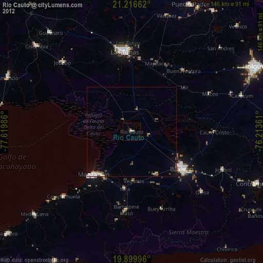
» Earth at Night: Flat Maps 2012, 2016