Manzanillo night lights from space
Night Light of Manzanillo (Granma) from space (Cuba) Src. Average luminocity for 10x10km area is 31.3731% and for 50x50km: 3.6627%.
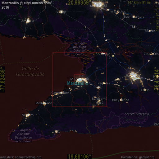
Analysis of Manzanillo night lights 2016
Square area 10x10 km:
 4.92%
4.92%90-99
8.71%80-89
4.92%70-79
1.14%60-69
3.03%50-59
0.76%40-49
3.03%30-39
3.03%20-29
2.65%10-19
44.13%0-9
23.67%Square area 50x50 km:
0.26%90-99
0.55%80-89
0.62%70-79
0.21%60-69
0.39%50-59
0.51%40-49
0.61%30-39
0.58%20-29
0.78%10-19
2.72%0-9
92.77%Clear (daylight) street map image can be seen on geolist.org.
Map coordinates:
20° 59' 58.5" North, 77° 49' 27.8" West
20° 20' 30.2" North, 77° 7' 16.5" West
19° 40' 51.8" North, 76° 25' 5.3" West
Some cities around Manzanillo sort by population:
• Bayamo
49.9 km =31 mi,  85°
85°
• Bartolomé Masó
27 km =16.8 mi,  136°
136°
• Yara
19.2 km =11.9 mi,  112°
112°
• Campechuela
20.5 km =12.7 mi,  233°
233°
• Río Cauto
32.3 km =20.1 mi,  41°
41°
• Niquero
58.1 km =36.1 mi,  235°
235°
• Guisa
61.5 km =38.2 mi,  99°
99°
• Media Luna
39.5 km =24.5 mi, 236°
3547867 (p: 128,188)
Sources (retrieved 2019-11-25):
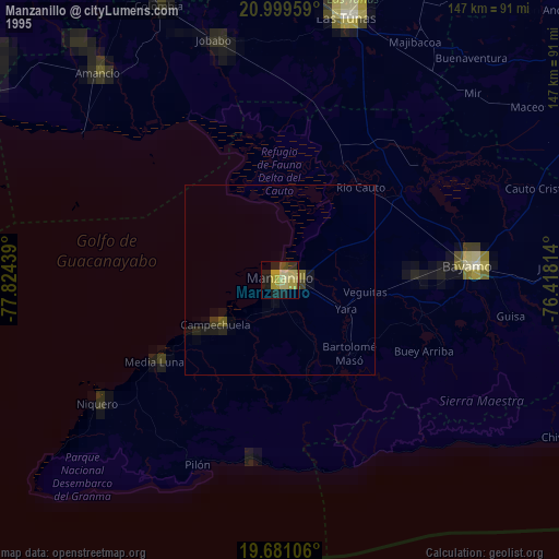
» NASA, Earths city lights 1995
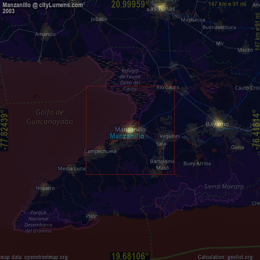
» NASA city lights 2003
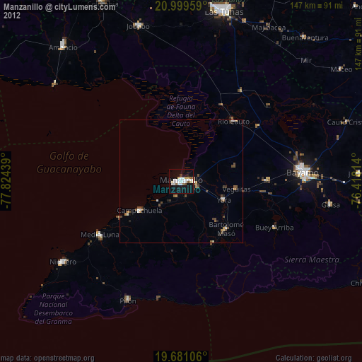
» Earth at Night: Flat Maps 2012, 2016