Bayamo night lights from space
Night Light of Bayamo (Granma) from space (Cuba) Src. Average luminocity for 10x10km area is 51.3333% and for 50x50km: 5.0394%.
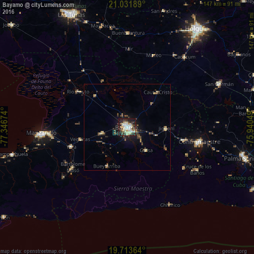
Analysis of Bayamo night lights 2016
Square area 10x10 km:
 7.58%
7.58%90-99
15.34%80-89
10.8%70-79
2.46%60-69
3.22%50-59
2.84%40-49
8.52%30-39
7.58%20-29
18.56%10-19
23.11%0-9
0%Square area 50x50 km:
0.34%90-99
0.88%80-89
0.74%70-79
0.31%60-69
0.49%50-59
0.86%40-49
1.08%30-39
0.96%20-29
1.29%10-19
3.25%0-9
89.81%Clear (daylight) street map image can be seen on geolist.org.
Map coordinates:
21° 1' 54.8" North, 77° 20' 48.3" West
20° 22' 27" North, 76° 38' 37" West
19° 42' 49.1" North, 75° 56' 25.8" West
Some cities around Bayamo sort by population:
• Manzanillo
49.9 km =31 mi,  265°
265°
• Contramaestre
42.4 km =26.3 mi,  101°
101°
• Bartolomé Masó
38.8 km =24.1 mi,  233°
233°
• Jiguaní
22.5 km =14 mi,  91°
91°
• Yara
33.9 km =21.1 mi,  250°
250°
• Río Cauto
35.1 km =21.8 mi,  305°
305°
• Cauto Cristo
27 km =16.8 mi,  41°
41°
• Guisa
17.1 km =10.6 mi,  140°
140°
3567597 (p: 192,632)
Sources (retrieved 2019-11-25):
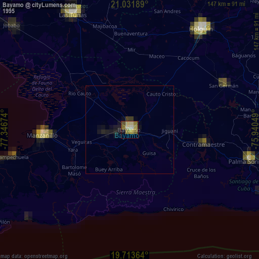
» NASA, Earths city lights 1995
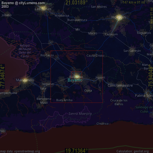
» NASA city lights 2003
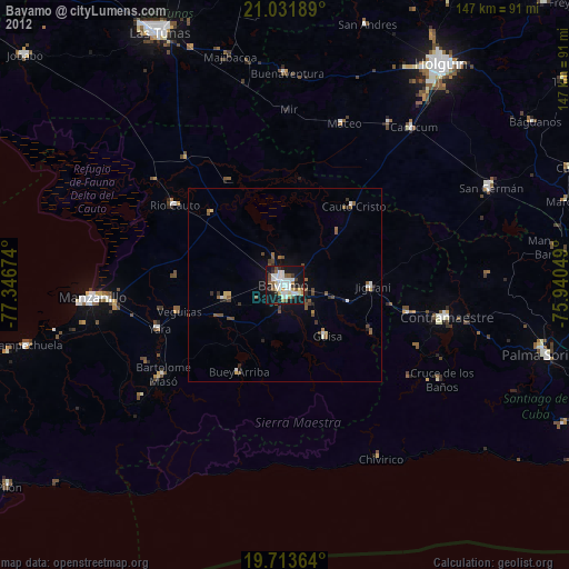
» Earth at Night: Flat Maps 2012, 2016