Campechuela night lights from space
Night Light of Campechuela (Granma) from space (Cuba) Src. Average luminocity for 10x10km area is 10.3234% and for 50x50km: 2.9513%.
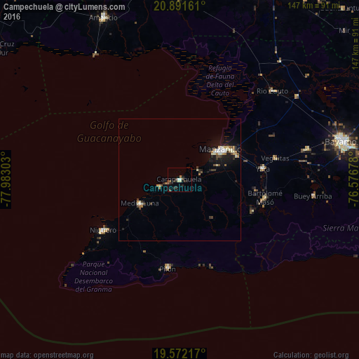
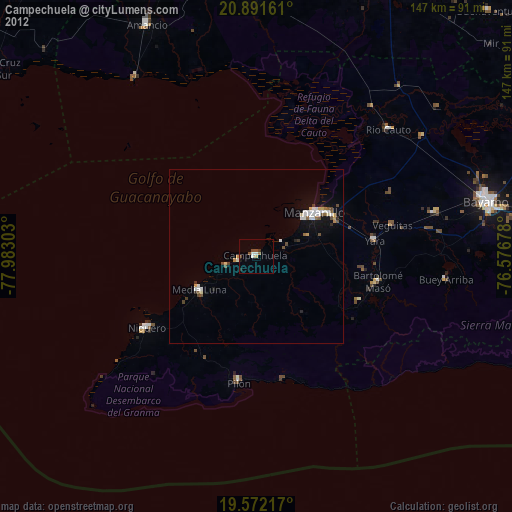
Analysis of Campechuela night lights 2016
Square area 10x10 km:
 0.79%
0.79%90-99
1.39%80-89
1.79%70-79
0%60-69
0.79%50-59
2.38%40-49
1.59%30-39
1.79%20-29
4.76%10-19
1.39%0-9
83.33%Square area 50x50 km:
0.25%90-99
0.55%80-89
0.43%70-79
0.19%60-69
0.31%50-59
0.31%40-49
0.43%30-39
0.47%20-29
0.54%10-19
2.42%0-9
94.1%Clear (daylight) street map image can be seen on geolist.org.
Map coordinates:
20° 53' 29.8" North, 77° 58' 58.9" West
20° 13' 59.8" North, 77° 16' 47.6" West
19° 34' 19.8" North, 76° 34' 36.4" West
Some cities around Campechuela sort by population:
• Bayamo
68.2 km =42.4 mi,  76°
76°
• Manzanillo
20.5 km =12.7 mi,  53°
53°
• Bartolomé Masó
35.9 km =22.3 mi,  101°
101°
• Amancio
72.2 km =44.9 mi,  334°
334°
• Yara
34.6 km =21.5 mi, 82°
• Río Cauto
52.4 km =32.6 mi, 46°
• Niquero
37.6 km =23.4 mi,  236°
236°
• Media Luna
19.1 km =11.9 mi, 238°
3565951 (p: 25,069)
Sources (retrieved 2019-11-25):
» Earth at Night: Flat Maps 2012, 2016