Nuevitas night lights from space
Night Light of Nuevitas (Camagüey) from space (Cuba) Src. Average luminocity for 10x10km area is 19.3826% and for 50x50km: 1.444%.
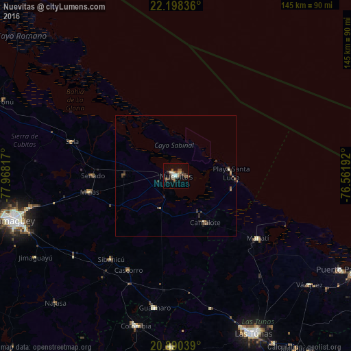
Analysis of Nuevitas night lights 2016
Square area 10x10 km:
 1.7%
1.7%90-99
3.98%80-89
0.38%70-79
1.52%60-69
2.46%50-59
4.55%40-49
5.11%30-39
3.03%20-29
3.03%10-19
6.82%0-9
67.42%Square area 50x50 km:
0.07%90-99
0.22%80-89
0.06%70-79
0.1%60-69
0.2%50-59
0.39%40-49
0.38%30-39
0.38%20-29
0.31%10-19
0.42%0-9
97.48%Clear (daylight) street map image can be seen on geolist.org.
Map coordinates:
22° 11' 54.1" North, 77° 58' 5.4" West
21° 32' 45.1" North, 77° 15' 54.1" West
20° 53' 25.4" North, 76° 33' 42.9" West
Some cities around Nuevitas sort by population:
• Camagüey
69.9 km =43.4 mi,  254°
254°
• Jobabo
71 km =44.1 mi,  181°
181°
• Guáimaro
55.6 km =34.5 mi,  189°
189°
• Jimaguayú
67.2 km =41.8 mi,  239°
239°
• Minas
36.3 km =22.6 mi,  259°
259°
• Colombia
64.2 km =39.9 mi,  195°
195°
• Sibanicú
43.7 km =27.2 mi,  218°
218°
• Manatí
43.1 km =26.8 mi,  127°
127°
3545841 (p: 54,022)
Sources (retrieved 2019-11-25):
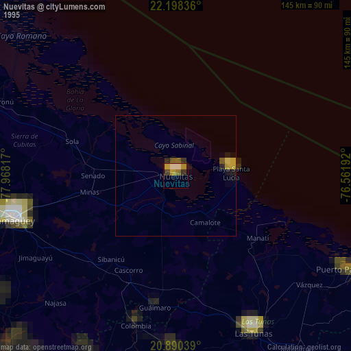
» NASA, Earths city lights 1995
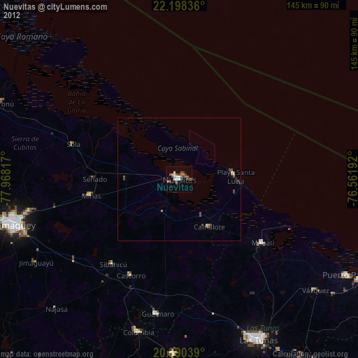
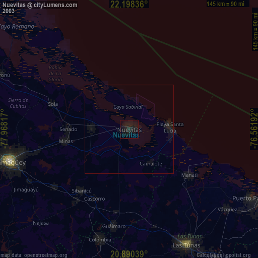
» NASA city lights 2003
» Earth at Night: Flat Maps 2012, 2016