Minas de Matahambre night lights from space
Night Light of Minas de Matahambre (Pinar del Río) from space (Cuba) Src. Average luminocity for 10x10km area is 2.1629% and for 50x50km: 0.8632%.
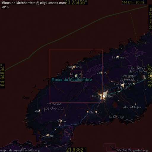
Analysis of Minas de Matahambre night lights 2016
Square area 10x10 km:
 0%
0%90-99
0%80-89
0.76%70-79
0.76%60-69
0%50-59
0.76%40-49
0%30-39
0.76%20-29
0%10-19
0%0-9
96.97%Square area 50x50 km:
0.01%90-99
0.01%80-89
0.12%70-79
0.35%60-69
0.05%50-59
0.17%40-49
0.09%30-39
0.18%20-29
0.13%10-19
0.75%0-9
98.15%Clear (daylight) street map image can be seen on geolist.org.
Map coordinates:
23° 14' 4.4" North, 84° 38' 55.1" West
22° 35' 12.9" North, 83° 56' 43.8" West
21° 56' 10.3" North, 83° 14' 32.6" West
Some cities around Minas de Matahambre sort by population:
• Pinar del Río
31.8 km =19.8 mi,  126°
126°
• Consolación del Sur
45.2 km =28.1 mi,  101°
101°
• Viñales
24.7 km =15.3 mi,  81°
81°
• Los Palacios
71.7 km =44.6 mi,  89°
89°
• Bahía Honda
87.9 km =54.6 mi,  66°
66°
• Guane
45.2 km =28.1 mi,  198°
198°
• Mantua
48.1 km =29.9 mi,  226°
226°
• San Luis
39.2 km =24.4 mi,  150°
150°
3546882 (p: 34,419)
Sources (retrieved 2019-11-25):
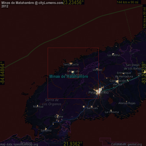
» Earth at Night: Flat Maps 2012, 2016