Matanzas night lights from space
Night Light of Matanzas from space (Cuba) Src. Average luminocity for 10x10km area is 43.7738% and for 50x50km: 4.5107%.
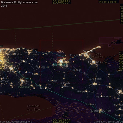

Analysis of Matanzas night lights 2016
Square area 10x10 km:
 3.37%
3.37%90-99
3.77%80-89
4.76%70-79
17.66%60-69
7.94%50-59
3.37%40-49
5.75%30-39
5.95%20-29
12.1%10-19
32.54%0-9
2.78%Square area 50x50 km:
0.15%90-99
0.19%80-89
0.37%70-79
1.26%60-69
0.75%50-59
0.44%40-49
1.1%30-39
0.75%20-29
1.11%10-19
3.88%0-9
89.99%Clear (daylight) street map image can be seen on geolist.org.
Map coordinates:
23° 41' 11.7" North, 82° 16' 50.3" West
23° 2' 28" North, 81° 34' 39" West
22° 23' 33.1" North, 80° 52' 27.8" West
Some cities around Matanzas sort by population:
• Cárdenas
38 km =23.6 mi,  90°
90°
• Madruga
32.1 km =19.9 mi,  242°
242°
• Unión de Reyes
27.7 km =17.2 mi,  171°
171°
• Limonar
19.8 km =12.3 mi,  120°
120°
• Varadero
36.4 km =22.6 mi,  69°
69°
• Santa Cruz del Norte
37.8 km =23.5 mi,  289°
289°
• Bolondrón
33.6 km =20.9 mi,  156°
156°
• Alacranes
30.5 km =19 mi,  178°
178°
3547398 (p: 146,733)
Sources (retrieved 2019-11-25):
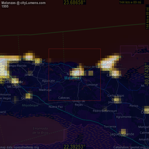
» NASA, Earths city lights 1995
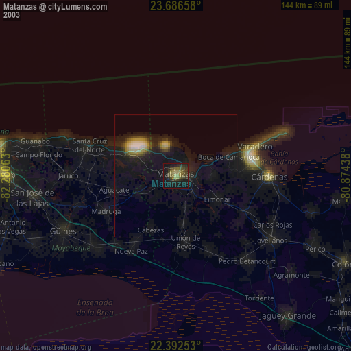
» NASA city lights 2003
» Earth at Night: Flat Maps 2012, 2016