Florencia night lights from space
Night Light of Florencia (Ciego de Ávila) from space (Cuba) Src. Average luminocity for 10x10km area is 1.4266% and for 50x50km: 1.5745%.
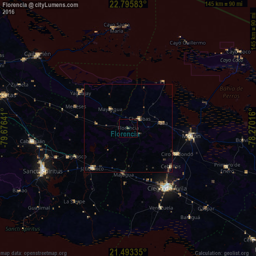
Analysis of Florencia night lights 2016
Square area 10x10 km:
 0%
0%90-99
0%80-89
0%70-79
0%60-69
0%50-59
0.79%40-49
0.79%30-39
0.79%20-29
0%10-19
0%0-9
97.62%Square area 50x50 km:
0.02%90-99
0.09%80-89
0.36%70-79
0.1%60-69
0.26%50-59
0.25%40-49
0.54%30-39
0.36%20-29
0.41%10-19
0.26%0-9
97.34%Clear (daylight) street map image can be seen on geolist.org.
Map coordinates:
22° 47' 45" North, 79° 40' 35.1" West
22° 8' 46" North, 78° 58' 23.8" West
21° 29' 36.1" North, 78° 16' 12.6" West
Some cities around Florencia sort by population:
• Ciego de Ávila
40.4 km =25.1 mi,  147°
147°
• Morón
36 km =22.4 mi,  96°
96°
• Yaguajay
33.7 km =20.9 mi,  306°
306°
• Ciro Redondo
31.2 km =19.4 mi,  116°
116°
• Chambas
8.3 km =5.2 mi,  48°
48°
• Jatibonico
30.3 km =18.8 mi,  221°
221°
• Venezuela
49.1 km =30.5 mi,  157°
157°
• Zaza del Medio
43.8 km =27.2 mi,  247°
247°
3558792 (p: 19,811)
Sources (retrieved 2019-11-25):
» Earth at Night: Flat Maps 2012, 2016