Boyeros night lights from space
Night Light of Boyeros (Havana) from space (Cuba) Src. Average luminocity for 10x10km area is 77.9921% and for 50x50km: 32.7308%.
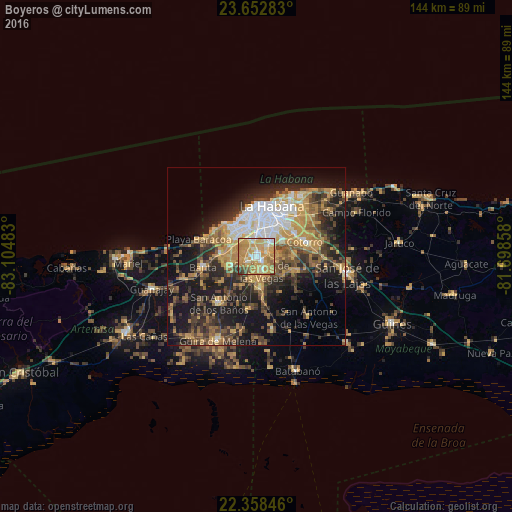
Analysis of Boyeros night lights 2016
Square area 10x10 km:
 8.73%
8.73%90-99
13.49%80-89
16.67%70-79
42.46%60-69
9.72%50-59
4.37%40-49
2.78%30-39
1.79%20-29
0%10-19
0%0-9
0%Square area 50x50 km:
3.72%90-99
3.9%80-89
3.37%70-79
9.23%60-69
4.5%50-59
4.48%40-49
6.1%30-39
5.92%20-29
8.63%10-19
18.36%0-9
31.79%Clear (daylight) street map image can be seen on geolist.org.
Map coordinates:
23° 39' 10.2" North, 83° 6' 17.4" West
23° 0' 25.9" North, 82° 24' 6.1" West
22° 21' 30.5" North, 81° 41' 54.9" West
Some cities around Boyeros sort by population:
• Havana
14.1 km =8.8 mi,  7°
7°
• Diez de Octubre
10 km =6.2 mi,  25°
25°
• Arroyo Naranjo
4.7 km =2.9 mi,  45°
45°
• San Miguel del Padrón
12.8 km =8 mi,  58°
58°
• Cerro
11.5 km =7.1 mi, 12°
• La Habana Vieja
14.6 km =9.1 mi,  19°
19°
• Santiago de las Vegas
4.4 km =2.7 mi,  159°
159°
• Bejucal
8.8 km =5.5 mi,  171°
171°
6956647 (p: 188,593)
Sources (retrieved 2019-11-25):
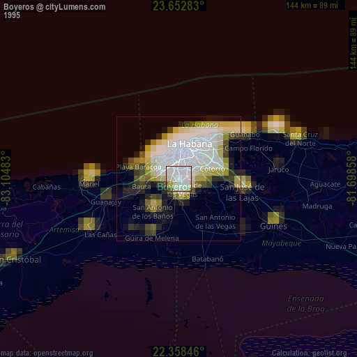
» NASA, Earths city lights 1995
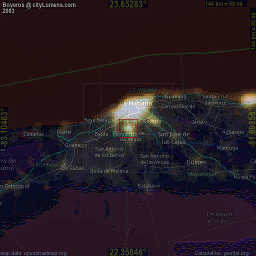
» NASA city lights 2003
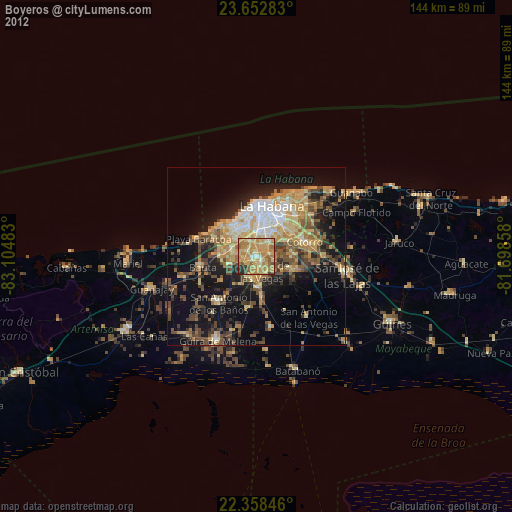
» Earth at Night: Flat Maps 2012, 2016