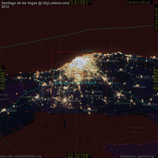
Santiago de las Vegas night lights from space
Night Light of Santiago de las Vegas (Havana) from space (Cuba) Src. Average luminocity for 10x10km area is 65.2758% and for 50x50km: 34.3247%.
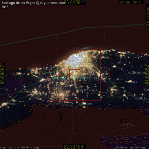
Analysis of Santiago de las Vegas night lights 2016
Square area 10x10 km:
 4.37%
4.37%90-99
7.14%80-89
10.91%70-79
32.74%60-69
11.9%50-59
7.94%40-49
9.52%30-39
5.75%20-29
9.33%10-19
0.4%0-9
0%Square area 50x50 km:
3.76%90-99
3.96%80-89
3.5%70-79
9.52%60-69
5.01%50-59
4.68%40-49
6.95%30-39
6.13%20-29
9.18%10-19
19.17%0-9
28.13%Clear (daylight) street map image can be seen on geolist.org.
Map coordinates:
23° 36' 56.9" North, 83° 5' 24.3" West
22° 58' 12" North, 82° 23' 13" West
22° 19' 15.9" North, 81° 41' 1.8" West
Some cities around Santiago de las Vegas sort by population:
• Diez de Octubre
13.4 km =8.3 mi,  11°
11°
• Arroyo Naranjo
7.6 km =4.7 mi, 13°
• Boyeros
4.4 km =2.7 mi,  339°
339°
• San Miguel del Padrón
14.3 km =8.9 mi,  41°
41°
• Cerro
15.4 km =9.6 mi,  3°
3°
• San Antonio de los Baños
14.7 km =9.1 mi,  232°
232°
• La Salud
11.5 km =7.1 mi,  198°
198°
• Bejucal
4.6 km =2.9 mi,  182°
182°
3536724 (p: 35,241)
Sources (retrieved 2019-11-25):
» Earth at Night: Flat Maps 2012, 2016