Tocaima night lights from space
Night Light of Tocaima (Cundinamarca) from space (Colombia) Src. Average luminocity for 10x10km area is 4.2541% and for 50x50km: 6.3612%.
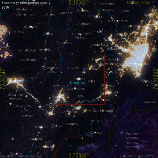
Analysis of Tocaima night lights 2016
Square area 10x10 km:
 0.41%
0.41%90-99
0.41%80-89
0.83%70-79
0%60-69
0%50-59
1.03%40-49
2.27%30-39
0.83%20-29
0%10-19
0%0-9
94.21%Square area 50x50 km:
0.51%90-99
0.69%80-89
0.53%70-79
0.81%60-69
0.75%50-59
1.25%40-49
1.11%30-39
1.65%20-29
1.18%10-19
4.77%0-9
86.75%Clear (daylight) street map image can be seen on geolist.org.
Map coordinates:
5° 9' 31.9" North, 75° 20' 14.9" West
4° 27' 29.5" North, 74° 38' 3.6" West
3° 45' 24.8" North, 73° 55' 52.4" West
Some cities around Tocaima sort by population:
• Girardot City
26 km =16.2 mi,  227°
227°
• Fusagasugá
32.9 km =20.4 mi,  114°
114°
• Melgar
28.2 km =17.5 mi,  181°
181°
• Flandes
27.5 km =17.1 mi, 227°
• Agua de Dios
9.9 km =6.2 mi,  203°
203°
• Silvania
28.1 km =17.5 mi,  102°
102°
• Viotá
12.7 km =7.9 mi, 100°
• Arbeláez
31.9 km =19.8 mi,  130°
130°
3667003 (p: 10,235)
Sources (retrieved 2019-11-25):
» Earth at Night: Flat Maps 2012, 2016