San Zenón night lights from space
Night Light of San Zenón (Magdalena) from space (Colombia) Src. Average luminocity for 10x10km area is 1.3333% and for 50x50km: 0.8046%.
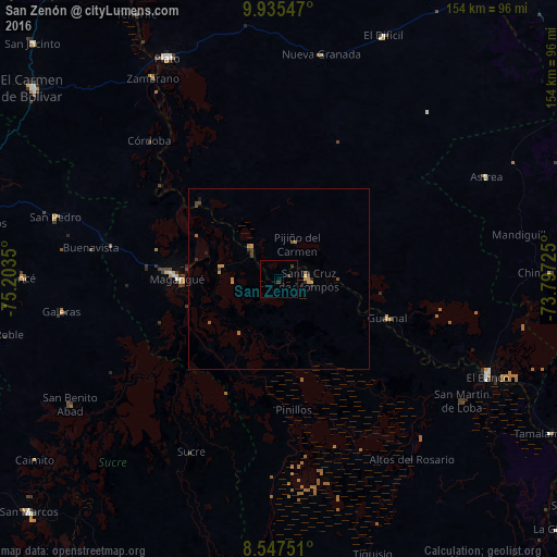
Analysis of San Zenón night lights 2016
Square area 10x10 km:
 0%
0%90-99
0%80-89
0%70-79
0%60-69
0%50-59
0%40-49
0%30-39
2.6%20-29
0%10-19
0%0-9
97.4%Square area 50x50 km:
0%90-99
0%80-89
0.03%70-79
0.32%60-69
0.15%50-59
0.14%40-49
0.19%30-39
0.23%20-29
0.09%10-19
0.2%0-9
98.64%Clear (daylight) street map image can be seen on geolist.org.
Map coordinates:
9° 56' 7.7" North, 75° 12' 12.6" West
9° 14' 31.8" North, 74° 30' 1.3" West
8° 32' 51" North, 73° 47' 50.1" West
Some cities around San Zenón sort by population:
• Magangué
27.9 km =17.3 mi,  269°
269°
• Mompós
8.1 km =5 mi,  90°
90°
• Santa Ana
11.5 km =7.1 mi,  319°
319°
• Guamal
32.3 km =20.1 mi,  109°
109°
• Cicuco
16.2 km =10.1 mi,  284°
284°
• Pinillos
36.1 km =22.4 mi,  174°
174°
• Talaigua Viejo
12.1 km =7.5 mi,  309°
309°
• Pijiño del Carmen
11 km =6.8 mi,  28°
28°
3668286 (p: 6,520)
Sources (retrieved 2019-11-25):
» Earth at Night: Flat Maps 2012, 2016