Pupiales night lights from space
Night Light of Pupiales (Nariño) from space (Colombia) Src. Average luminocity for 10x10km area is 15.9307% and for 50x50km: 4.3551%.
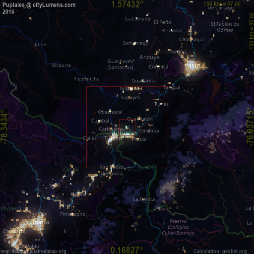
Analysis of Pupiales night lights 2016
Square area 10x10 km:
 1.73%
1.73%90-99
1.73%80-89
1.73%70-79
1.73%60-69
0.87%50-59
1.73%40-49
3.9%30-39
1.73%20-29
1.95%10-19
25.76%0-9
57.14%Square area 50x50 km:
0.4%90-99
0.61%80-89
0.53%70-79
0.45%60-69
0.48%50-59
0.42%40-49
0.83%30-39
0.98%20-29
0.52%10-19
4.01%0-9
90.78%Clear (daylight) street map image can be seen on geolist.org.
Map coordinates:
1° 34' 27.6" North, 78° 20' 36.2" West
0° 52' 16.9" North, 77° 38' 25" West
0° 10' 5.8" North, 76° 56' 13.7" West
Some cities around Pupiales sort by population:
• Tulcán, EC
10.8 km =6.7 mi,  232°
232°
• Ipiales
5.2 km =3.2 mi,  179°
179°
• Túquerres
24 km =14.9 mi,  5°
5°
• San Gabriel, EC
37.5 km =23.3 mi,  214°
214°
• Olaya Herrera
45.1 km =28 mi,  21°
21°
• Cumbal
17.3 km =10.7 mi,  283°
283°
• Guaitarilla
30.6 km =19 mi, 19°
• Ancuya
45.8 km =28.5 mi, 17°
3671228 (p: 6,760)
Sources (retrieved 2019-11-25):
» Earth at Night: Flat Maps 2012, 2016