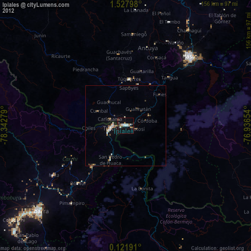
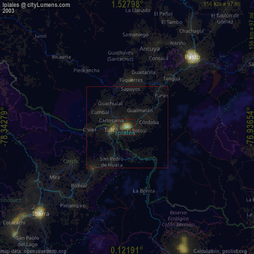
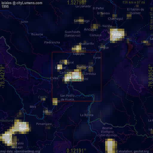
Ipiales night lights from space
Night Light of Ipiales (Nariño) from space (Colombia) Src. Average luminocity for 10x10km area is 29.645% and for 50x50km: 4.4277%.
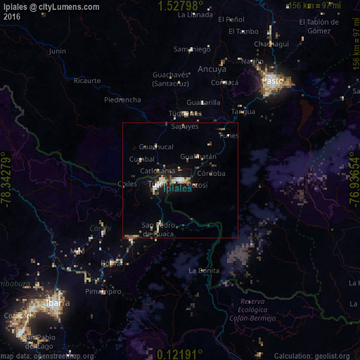
Analysis of Ipiales night lights 2016
Square area 10x10 km:
 3.68%
3.68%90-99
3.25%80-89
4.55%70-79
4.76%60-69
3.68%50-59
1.52%40-49
6.49%30-39
3.25%20-29
2.81%10-19
46.97%0-9
19.05%Square area 50x50 km:
0.39%90-99
0.61%80-89
0.46%70-79
0.49%60-69
0.48%50-59
0.45%40-49
0.91%30-39
0.94%20-29
0.54%10-19
3.97%0-9
90.75%Clear (daylight) street map image can be seen on geolist.org.
Map coordinates:
1° 31' 40.7" North, 78° 20' 34" West
0° 49' 30" North, 77° 38' 22.8" West
0° 7' 18.9" North, 76° 56' 11.5" West
Some cities around Ipiales sort by population:
• Tulcán, EC
8.8 km =5.5 mi,  260°
260°
• Túquerres
29.2 km =18.1 mi,  4°
4°
• San Gabriel, EC
33.4 km =20.8 mi,  219°
219°
• Olaya Herrera
49.9 km =31 mi,  19°
19°
• Cumbal
19.3 km =12 mi,  298°
298°
• Pupiales
5.2 km =3.2 mi,  359°
359°
• Guaitarilla
35.5 km =22.1 mi, 16°
• Ancuya
50.7 km =31.5 mi, 16°
3680539 (p: 77,729)
Sources (retrieved 2019-11-25):
» NASA, Earths city lights 1995
» NASA city lights 2003
» Earth at Night: Flat Maps 2012, 2016